
You come down to Kamari with the Aegean in front of you and a steep rock mountain rising behind the village. The shoreline is the color of cooled lava, a reminder that every beach on Santorini is a product of its volcano. Kamari is a seaside stop on the island where the day revolves around the water, a meal by the shore and a look at the ancient city on the mountain above.
Is visiting Kamari Beach worth it?
Yes, if you want a beach day on Santorini that sits next to a piece of ancient history, rather than a view down into the caldera.
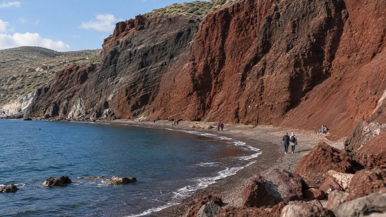
What sets it apart from other beaches on the island is its setting. Santorini is known for beaches of sand or pebbles made of solidified lava in different colors, with a Red Beach, a Black Beach and a White Beach among them. Kamari belongs to that family, with dark volcanic tones along the water.
Behind it rises Mesa Vouno, the mountain on which the main Hellenic city of Ancient Thera was founded in the ninth century BC, 1,299 feet above sea level. Few beaches put a swim and an ancient city so close together, and that pairing is the reason to come.
The caldera side of Santorini is a sheer cliff, with a drop of more than 980 feet at its highest. Kamari offers something different from that drama: a stretch of shore where you sit at water level, look out to the open Aegean and let the afternoon slide by.
What to see at Kamari Beach
A visit to Kamari has three parts: the shore itself, the mountain behind it and the village between them. Each gives you something different, and together they fill a full day.
The lava-colored shoreline
The first thing you notice is the dark tone of the ground. Santorini’s beaches are made of sand or pebbles of solidified lava, and the colors change from one beach to the next. At Kamari the shoreline carries that volcanic look, with the sea set against a dark edge.
Walk along the water and look at the stones and grains underfoot. They are small pieces of the same eruption history that shaped the whole island and its circular archipelago. It is a simple way to see the volcano without visiting it.
Mesa Vouno and Ancient Thera
Santorini was known in ancient times as Thera, and the city that carried that name was founded on Mesa Vouno, the mountain that stands over Kamari. The site is 1,299 feet above sea level, so the ruins look down on the coast you are sitting on.
From the beach, simply lift your eyes. The rock face behind the village is the seat of an ancient city, and knowing that changes how the whole shore reads. Visitors who want to go up should treat it as its own outing and not as an add-on to the beach.
The village behind the shore
Between the water and the mountain lies the village, with its tavernas, cafés and shops. This is where you take a break from the sun with a plate of grilled fish, a Greek salad with feta, or a cold drink and a plate of meze, the small shared dishes that start a Greek meal.
Santorini’s cooking leans on local produce, such as small tomatoes, fava made from yellow split peas, and white eggplant. Look for them on menus here. Eating by the sea after a swim is the natural rhythm of a day at Kamari.
Hours, tickets and rules
Kamari is a stretch of coast on a living island, and what it offers is the shore, the water and the village along it. The part of the visit with a formal side is the ancient city on Mesa Vouno, which belongs to the same story as Santorini’s other great excavation at Akrotiri, where a major Minoan town with multi-level buildings, streets and squares has been uncovered, with walls standing as high as eight meters.
Akrotiri has its own history of closure. The canopy over the ruins collapsed in September 2005, and the site stayed closed until April 2012 while a new canopy was built. It is the reason you will hear Akrotiri described as a site with a new roof, and it makes a useful contrast with Kamari, where the draw is an open shoreline rather than a covered excavation.
For a beach day, the plan is simple: arrive, swim, eat, and look up at the mountain. The ancient sites of the island are best thought of as separate visits, each with its own character.
How to get to Kamari Beach
Kamari is on Santorini, so the trip starts with reaching the island. Santorini is a Greek island in the southern Aegean Sea, about 120 miles southeast of the mainland, and it is the southernmost member of the Cyclades.
By air
Santorini Airport lies about 4 miles southeast of downtown Thera, and its main asphalt runway is 6,972 feet long. If you fly in, you land on the island itself and are already close to the places where the beach villages sit.
From the airport you continue to Kamari on your own arrangements. The island is small enough that you spend your time at the beach rather than in transit.
By sea
Santorini is connected by ferry with Piraeus on a daily basis all year long, with up to 5 direct crossings during summer. Arriving by ferry gives you the sight of the island rising from the sea, with the caldera cliff running along the coast.
Cruise ships work differently. They anchor off Skala, the old port of Santorini, and passengers are transferred by local boatmen to shore, where Fira is reached by cable car, on foot, or by donkeys and mules. A cruise day therefore starts at Fira, and Kamari is a separate stop from there.
When to visit Kamari Beach
July is the month for a full beach day, with hot air and almost no rain. October still works well for swimming and lingering on the shore, with warm afternoons and a few showery days. January and April are for the ancient city and the village, not for a swim.
| Month | Average high (°F) | Average low (°F) | Precipitation (inches) | Days with rain (1 mm or more) |
|---|---|---|---|---|
| January | 57.9 | 49.8 | 2.37 | 10.3 |
| April | 66.0 | 55.9 | 0.63 | 3.6 |
| July | 85.5 | 73.9 | 0.01 | 0.1 |
| October | 73.6 | 63.9 | 0.94 | 3.8 |
In July the heat is real, so sun protection is a sensible thing to carry, and the shore is a place to cool off. The meltemi, a strong, dry north wind of the Aegean that blows periodically from about mid-May to mid-September, belongs to the same stretch of the year, and it can shape how a day on the Aegean feels.
October brings a softer version of the same island. January is the wet month of the table, with rain on about one day in three, and it is a time for the village rather than the water.
April sits in between, with drier days and cooler air. It suits a walk along the shore and a meal by the sea more than a long swim.
Tips for your visit
Bring what a beach day asks for: a swimsuit, a towel and sun protection in the warm months. In winter the table points to a rain jacket and warm layers instead.
Pair the beach with the mountain behind it. Ancient Thera on Mesa Vouno, founded in the ninth century BC, belongs to the same landscape, so you can fold a look at the ancient city into a day at the sea. If you want a second archaeological stop, Akrotiri is the island’s other great excavation, with its streets and squares of a Minoan town.
For an evening, return to the village for a taverna dinner. Grilled fish, a plate of fava, tomato salad and a glass of local white wine are the kind of things Santorini does well.
Santorini draws an estimated 2 million tourists a year, so the island as a whole is a busy place. Planning your beach day around the shore and the village, and treating the caldera views and ancient sites as separate outings, keeps the day focused.
Good to know before you go
Santorini sits on an active volcano, and its caldera is one of the island’s great sights. The Blue Flag is a certification from the Foundation for Environmental Education that a beach meets its standards, and it is a label travelers sometimes look for when choosing where to swim. In the warm months, the Aegean meltemi can blow strongly, and the summer sun is strong, so carry water and sun protection.
Sources
- Wikipedia, Santorini (https://en.wikipedia.org/wiki/Santorini), checked October 12, 2026
- Santorini official guide (https://www.santorini.gr/), checked October 12, 2026
- Visit Greece (GNTO), Santorini (https://www.visitgreece.gr/islands/cyclades/santorini/), checked October 12, 2026
- Hellenic National Meteorological Service (HNMS), climatological normals 1991-2020 for Santorini station (https://www.emy.gr/climatic-data), monthly mean daily maximum and minimum; rain from the ECMWF ERA5 reanalysis, 1991-2020, grid cell of Santorini (Open-Meteo), checked October 12, 2026
- ECMWF ERA5 reanalysis 1991-2020, grid cell of Santorini (Open-Meteo), checked October 12, 2026
- Wikipedia, Blue Flag beach (https://en.wikipedia.org/wiki/Blue_Flag_beach), checked October 12, 2026
- Wikipedia, Meltemi (https://en.wikipedia.org/wiki/Meltemi), checked October 12, 2026
To plan your stay
- Agia Marina Beach near Chania: Setting, Seasons and the Old Town Next Door
- The Beaches of Antiparos: Sandy Shores, Nudist Coves, the Cave and Despotiko
- Agios Gordios Beach on Corfu: Ai Gordis Village, the Pink Palace, Weather by Season and Tips
- Agios Prokopios Beach: Naxos Setting, Seasons, Food and Nearby Sights