
KEY WEST · SAFETY · MILE MARKER 0
You’ve already picked the island. So the useful question is not whether to come, but what genuinely goes wrong at the end of a 113-mile chain of bridges, where the road stops at Mile Marker 0 on the corner of Whitehead and Fleming, and a sign points 2,370-odd miles north to Fort Kent, Maine.
The answers are less lurid than the internet suggests. Key West’s hazards are the ones an island has: warm water that keeps you in it too long, a sun that does its work by 11 a.m., a bridge nobody should stop on, and a storm calendar that runs from June 1 to November 30. Almost none of it involves the walk back from Duval Street.
SAFETY AT A GLANCE · KEY WEST
Water, heat and a single road shape a safe day here: the island itself is flat and walkable, and the June-to-November calendar changes more plans than anything else.
HURRICANE SEASON: JUN 1 – NOV 30 · PEAK SEPT 10 · NO STOPPING ON THE SEVEN MILE BRIDGE
Go for: a flat, compact island you can cover on foot or by bicycle, water at 88.7°F in July, and a restored two-mile span of the old Seven Mile Bridge where the photo is legal to take.
Think twice before: booking non-refundable between mid-August and mid-October, the stretch NOAA counts as the season’s busiest, on an island reached by one road.
Storms: NOAA National Hurricane Center · Climate: NOAA station USW00012836 · Beach fees: Florida State Parks · full sources at the end
On this page
- Is Key West safe?Water, heat and the single road
- Stopping on the Seven Mile Bridge for a photoNo stopping · the old span at Marathon
- Swimming and boat traffic in Key WestFlags, channels and Fort Zachary Taylor
- Hurricane season dates and the ferry ticketJune 1 to November 30, peak September 10
- Do cruise ships still dock here?The 2020 vote and SB 1194
- Statewide rules and the emergency numberFlorida safety
Start with the sun, because it is the one hazard that arrives every single day. July averages a high of 90.2°F and a low of 80.6°F, with 13 hours 33 minutes of daylight on the 15th and the sun still up until roughly 8:19 p.m. local time. Every temperature figure here comes from NOAA’s 1991-2020 normals at station USW00012836 (Key West International Airport), except the sea readings, which are Open-Meteo means of daily maxima for 2015-2024.
Is Key West safe?
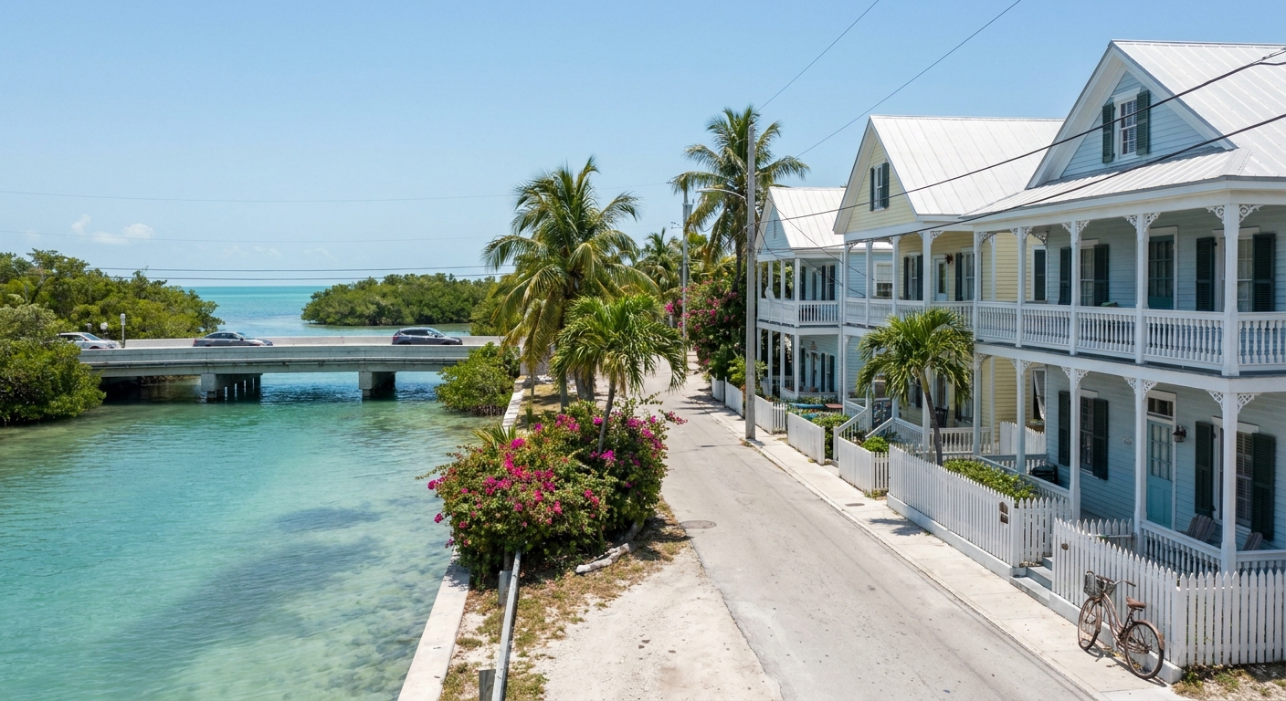
Frankly, the things that send visitors home early are water, sun and traffic, in that order. We carry no crime statistics for Key West and won’t improvise any, so you will not find a ranking of streets here. What we can document is that the island is flat, that Old Town is the largest wooden historic district in North America and was built to be crossed on foot or by bicycle, and that the closest thing to a drop on this island is a curb.
That flatness quietly removes the risk most island destinations carry. Nobody is negotiating a coastal road with a sheer edge, because the car is the wrong tool: street meters run $3.00 an hour, the Old Town Parking Garage $6 an hour or $48 a day plus tax, the Mallory Square lot $7 an hour or $48 a day with a ten-hour cap, the Key West Bight lot $5 an hour or $40 a day. The free Duval Loop bus calls at 18 stops through Old Town, though published frequencies and hours diverge between the city and local guides, so read the sign at your stop. It does not serve the airport.
Everything that is statewide rather than islandwide lives one page up: the emergency number, driving rules, wildlife, the general cautions that apply from Pensacola to here. See Florida safety for those, and treat the sections below as the local supplement, not a replacement.
Seven Mile Bridge: can you stop on it?
No. Travel with that as a flat rule: there is no safe place to stop on the Seven Mile Bridge itself. Not for the photograph, not for the drone, not for the passenger who has just noticed the color of the water. Whatever you have seen posted from the driving lanes was somebody’s bad decision.
The picture exists a few feet away. The old bridge running alongside has a restored two-mile span open to walkers and cyclists, with a car park at the Marathon end, and Pigeon Key sits out in the middle of it. That is the legal, unhurried version of the same view, taken from a deck with nothing overtaking you.
So build it into the drive rather than fighting for it at 45 mph. Park at Marathon, walk out as far as the light and the heat allow, and turn around. In July, with highs at 90.2°F (NOAA station USW00012836), the sensible half of that walk happens early or late in the day.
The wider point is that this is a single road. US-1 is the only road south of Florida City, running 113 miles with mile markers counting down from about 126 to zero, and from Miami the trip is roughly four hours without stops (about 155 miles in total), six to eight with them. An incident ahead of you has no detour behind it. Getting around Florida covers the all-electronic toll road that feeds it.
Swimming in Key West: currents and boat traffic
Here is what we could not read, said plainly: the sources we checked gave us no rip-current statistics, no lifeguard hours and no flag-system schedule for Key West beaches, and we’re not going to invent a set. Read the flags where you swim, ask the park staff on your way in, and stay inside marked areas, because the water off this island is working water. The Dry Tortugas ferry leaves at 8 a.m. daily and seaplanes use the same surface. Warmth is the trap the numbers do show: 88.7°F in July, 76.5°F in January, which keeps people in the sea far longer than they intended.
The beach most often called the best on the island is at Fort Zachary Taylor Historic State Park, and it is within walking distance of Old Town. Entry is $6.00 per vehicle for up to eight people plus a $0.50 county surcharge per person, $4.50 for a single-occupant vehicle or motorcycle, and $2.50 if you arrive on foot or by bicycle. The park runs 8 a.m. to sundown, 365 days a year, with the fort itself closing at 5 p.m.
Hurricane season in the Florida Keys
The Atlantic hurricane season runs June 1 to November 30 and peaks on September 10, with most activity falling between mid-August and mid-October (NOAA National Hurricane Center). Those five weeks either side of the peak are the ones that decide whether a Keys trip is a bargain or a rebooking.
On an island at the end of a road, the boats go first. Dry Tortugas National Park has no road or bridge at all: it sits 70 miles west and is reached only by ferry or seaplane, both of which answer to the sea state long before any road closes. We have no published closure thresholds for either, so treat a marginal forecast as a probable cancellation and keep the day flexible.
That matters for a ticket of real money. The Yankee Freedom III leaves Key West daily at 8 a.m., check-in before 7:30 a.m., and the 2026 adult fare is about $250 including the park entrance fee, snorkeling gear, breakfast and lunch. It sells out weeks ahead, so a month’s notice is the working minimum. We could not read its refund and weather-cancellation terms, so ask the operator directly when you book, and see our Dry Tortugas guide for the shape of the day.
Evacuation deserves neither drama nor a shrug. If an order is issued for the Keys, the way out is the same US-1 you drove in on, 113 miles of two-lane road with no parallel route, shared with everyone else leaving. Key West also has its own airport, EYW, which is about 155 miles and close to 3 hours 40 minutes from Miami by road. Leaving early is the whole strategy, and it is a decision made in hours, not minutes.
On the day itself, read the primary sources rather than a repost: the National Hurricane Center for the storm, and Monroe County’s emergency management channels for local orders and bridge status. For the seasonal shape before you book, the month-by-month view of Key West and the statewide calendar both start from these same NOAA dates.
Do cruise ships still dock in Key West?
In November 2020 Key West voters approved three limits on cruise traffic: a cap of 1,500 disembarking passengers a day, a ban on ships carrying more than 1,300 people, and docking priority for lines with the best environmental and health records. It was, for a few months, the strictest local cruise rule in Florida.
Then the state overrode it. Governor Ron DeSantis signed SB 1194, under which a local ballot initiative or referendum may not restrict maritime commerce in Florida ports, and the law was written to apply retroactively to those November votes. So the ships call, the sidewalks of Old Town fill on port mornings, and the sunset crowd at Mallory Square (nightly, weather permitting, from about two hours before sunset) is the visible result. Plan your walking around it rather than against it, with the three-day plan.
Sources & data for this guide
- No safe stopping on the Seven Mile Bridge · restored two-mile old span open to walkers and cyclists, car park at the Marathon end, Pigeon Key mid-span · Florida Rambler + Visit Florida · checked Sep 10, 2026
- Fort Zachary Taylor entry fees and 8 a.m. to sundown hours, fort closing 5 p.m. · Florida State Parks · checked Sep 10, 2026
- Hurricane season dates, Sept 10 peak, mid-August to mid-October concentration · NOAA National Hurricane Center · checked Sep 10, 2026
- July and January normals (90.2°F / 80.6°F, 75.8°F / 65.5°F) · NOAA NCEI 1991-2020, station USW00012836, Key West International Airport · checked Sep 10, 2026
- Sea surface 88.7°F July and 76.5°F January · Open-Meteo Marine, mean of daily maxima 2015-2024, a shade warmer than a 24-hour mean · checked Sep 10, 2026
- Daylight 13 h 33 on July 15, sunrise and sunset converted to America/New_York · sunrise-sunset.org · checked Sep 10, 2026
- Yankee Freedom III 8 a.m. departure, 7:30 a.m. check-in, about $250 adult in 2026 · drytortugas.com · checked Sep 10, 2026 · refund and weather-cancellation terms were not readable, ask the operator
- US-1 as the only road south of Florida City, 113 miles, mile markers from about 126 to 0, all-electronic toll road from Miami · Florida Turnpike + AARoads · checked Sep 10, 2026 · drive times indicative
- Mile Marker 0 at Whitehead and Fleming, roughly 2,370 miles to Fort Kent, Maine · sources give 2,369 and 2,390, so we give the order of magnitude · checked Sep 10, 2026
- Parking rates ($3.00 meters, $6 / $48 garage, $7 / $48 Mallory Square, $5 / $40 Key West Bight) · City of Key West Parking Department · checked Sep 10, 2026 · rates change
- Duval Loop: free, 18 stops, does not serve the airport · published frequency and service hours diverge between the city and local guides, so we give the range and send you to the stop sign · checked Sep 10, 2026
- 2020 referendum limits and SB 1194 preemption · Seatrade Cruise + Florida Politics · checked Sep 10, 2026
- Editorial admission: we carry no crime statistics, no clinic addresses and no rip-current or lifeguard data for Key West beaches, and nothing here is medical advice. If someone is hurt, call for help and let the responders decide.