
KEY WEST · DAY TRIPS · MILE MARKER 0
US-1 ends here. Mile Marker 0 stands at the corner of Whitehead and Fleming, the southern terminus of a road that runs roughly 2,370 miles north to Fort Kent, Maine (published figures land between 2,369 and 2,390). Every land trip out of town therefore starts on the same two lanes, headed the same way, through the same pinch points. The best day away from the island doesn’t use the road at all.
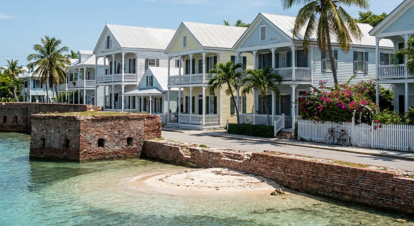
Boat first, mile markers second. The ferry west leaves at 8 a.m. and takes the entire day. A drive up the Keys gives back whatever the traffic decides to give back. And a fair amount of what visitors drive for is already underfoot: Old Town is the largest wooden historic district in North America, flat and compact, better covered on foot or by bicycle than through a windshield.
THE DAY TRIPS AT A GLANCE · KEY WEST
From Mile Marker 0 the day trips that repay you go west by boat or a short way north by mile marker, and Miami is not one of them at about 155 miles each way.
FERRY WEST AT 8 A.M. · CHECK-IN CLOSES 7:30 · ONE ROAD NORTH, NO DETOUR
Go for: the fort and reef 70 miles west, the restored two-mile walk on the old Seven Mile Bridge, Bahia Honda’s sandbars, and a beach you can reach on foot at Fort Zachary Taylor.
Think twice before: booking Miami as a day, or a September crossing that nobody will confirm until the morning of.
NPS · Yankee Freedom · Florida State Parks · City of Key West · NOAA · full sources at the end
On this page
- Dry Tortugas National Park in one dayThe 8 a.m. ferry and the 2026 fare
- Walking the old Seven Mile BridgeThe restored two-mile span, Marathon end
- Driving up the Keys and back in a dayNamed stops and the turnaround hour
- Key West to Miami in a day155 miles, close to 3 h 40 each way
- Hurricane season dates for the KeysJune 1 to Nov 30, peak Sept 10
- What the fort looks like on arrivalThe Dry Tortugas guide
One line item before you commit a day: the rental sitting still while you’re on the water. The Key West Bight lot charges $5 an hour or $40 a day, the Old Town Parking Garage $6 an hour or $48 a day plus tax, and street meters run $3 an hour. Those rates come from the city’s parking department and are the kind that change. Add them to whatever you thought the drive north was going to cost.
Dry Tortugas: the ferry, the fare and how early to start
The park has no road and no bridge. It sits 70 miles west of the island, and the National Park Service lists two ways in: ferry or seaplane. That single sentence does more scheduling work than any itinerary, because it means the day is not yours to shorten. You leave when the boat leaves and you come back when it comes back.
The ferry is the Yankee Freedom III. It departs Key West daily at 8 a.m., with check-in closing before 7:30 a.m., and it sells out weeks ahead. Book a month out at minimum. Walk-up hope is not a plan on this crossing, and a missed check-in is a forfeited day rather than a later sailing.
The 2026 adult fare comes in at about $250, which covers the park entrance fee, snorkeling gear, breakfast and lunch. Compared with a boat trip that feeds you nothing and lands you nowhere, that reads better than the sticker suggests. Fares for the coming season are still subject to change, so confirm on the operator’s booking page rather than on ours.
An eight o’clock departure with a 7:30 cutoff sets the night before. Sleeping up the Keys means a dark drive with zero margin, so this is the one day that argues for a bed in Old Town within walking distance of the dock. If you were counting on the free Duval Loop, read the printed stop sign first: sources disagree sharply, one giving 8 a.m. to 10 p.m. every 20 minutes, another 6 a.m. starts every 30 minutes then every 15 until midnight. It calls at 18 stops and never at the airport.
The seaplane is the other way west, and we couldn’t price it. No 2026 fare and no flight time for the Key West run held up to checking, so we’re leaving both blank instead of guessing. Ask the park’s air concessioner or the National Park Service desk when you weigh it against the $250 seat on the boat. What waits at the far end, fort walls, moat and reef, is in our Dry Tortugas guide.
The Seven Mile Bridge: why you cannot stop, and where you can walk
There is no safe place to stop on the Seven Mile Bridge. Two lanes, narrow shoulders, traffic that keeps moving. The span carries you across and that is the whole of its job. Guides that mention pullouts up on the bridge are describing something that isn’t there, which is how a lot of drivers end up crossing twice and photographing nothing.
The old bridge runs alongside, and two restored miles of it are open to walkers and cyclists, with a car park at the Marathon end. Pigeon Key sits out in the middle of that span. This is the version of the bridge people picture: water on both sides at eye level, no engine noise at your shoulder, the new highway humming a hundred feet away.
So the photograph is taken on foot, from the old deck, and it costs you a walk rather than a risk. The one figure we can’t hand you is the drive: we found no official published time from Key West to the Marathon car park, and the mile markers counting down to 0 are the only measure US-1 offers. Check live traffic the morning you go, or ask at your front desk before committing the afternoon.
Florida Keys day trip by car from Key West
Northbound, the mile markers count up. The Overseas Highway runs 113 miles between MM 0 in Key West and roughly MM 126 at Florida City, and the interest is not evenly spread along it. Water on both shoulders, bridge after bridge, then a stretch of strip mall, then more water. A day trip up the Keys is a question of how many markers you’re willing to buy.
US-1 is the only road from Florida City south, and that single fact is the entire traffic story: no alternative route exists to absorb a crash or a slow truck. The published run from Miami is about four hours without stops and six to eight with them, for around 155 miles. Same road, same distance, two different days.
Worth the mileage: the old bridge walk and Pigeon Key at Marathon, the sandbars at Bahia Honda, the waterfront fish houses of Islamorada. Not worth the mileage: a beach. Fort Zachary Taylor holds the strand most people call the best in Key West, within walking distance of Old Town, at $6 per vehicle for up to eight people plus a $0.50 county surcharge each, $4.50 for a single-occupant vehicle, $2.50 on foot or by bicycle. It opens 8 a.m. to sundown, 365 days a year, and the fort itself closes at 5 p.m.
Winter light is the constraint nobody budgets for. On January 15 the sun sets at 6:01 p.m., with 10 hours 49 minutes of daylight, so turning around by three keeps the long bridges in daylight and out of headlight glare. July 15 gives you until 8:19 p.m. and 13 hours 33 minutes. Fix the turnaround hour before you leave, not at the far end when the water looks its best.
Can you day-trip from Key West to Miami?
The road distance is about 155 miles, and the Miami airport to Key West run reads at close to 3 hours 40 minutes one way in ordinary conditions. Return it and you’re past seven hours at the wheel, before lunch, before a wrong turn, before the two-lane incident that has nowhere to divert. Both numbers are indicative rather than guaranteed.
North of Florida City the route becomes the Homestead Extension of Florida’s Turnpike, an all-electronic toll road with no cash booths. Nobody takes your money at a window. Either accept the rental company’s transponder or accept its plate-billing fee, a choice we break down in getting around Florida.
Verdict: no, not as a day. Seven hours of driving buys you perhaps four in the city, arriving frayed and leaving into rush hour, and the Keys scenery you paid for gets crossed twice in the dark. Miami deserves two or three nights of its own. Key West has an airport of its own, EYW, which makes a one-way rental north or a flight out the sane way to change cities.
Hurricane season in the Florida Keys: dates and what closes
Atlantic hurricane season runs June 1 to November 30, peaks on September 10, and concentrates most of its activity between mid-August and mid-October, per the National Hurricane Center. The heat is the other half of that calendar. Every figure here for weather comes from NOAA’s 1991 to 2020 normals at station USW00012836, Key West International: a July average high of 90.2°F, a low of 80.6°F, and 3.63 inches of rain spread over 6.8 days recording at least a tenth of an inch.
First thing off the table is the crossing. Open water 70 miles west shows a distant system long before the sky over Duval Street does, and we found no published cancellation threshold for the ferry, so the operator’s morning call is the only one that counts. Ask how it handles weather cancellations at the time of booking. The old bridge walk and the drive north are sturdier plans, though an afternoon storm on a road with no detour stretches three hours into five.
Some of what travelers try to reach from here belongs to a different bed altogether. The Everglades boardwalks are a morning out of Homestead or Miami and a whole day of driving from Mile Marker 0, and the same arithmetic sinks the springs and the rocket launches. The island’s compensation on a canceled-crossing day is close at hand: the Hemingway Home takes walk-in visits 9 a.m. to 5 p.m. every day, $19 adults and $7 children, free under 6. Mallory Square’s sunset celebration runs every night of the year, weather permitting, starting about two hours before sundown.
Sources & data for this guide
- Dry Tortugas access, 70 miles west, no road or bridge · National Park Service · checked Sep 10, 2026
- Yankee Freedom III 8 a.m. departure, 7:30 check-in, 2026 adult fare about $250 including entrance, gear and meals · drytortugas.com · checked Sep 10, 2026 · fares change
- No stopping on the Seven Mile Bridge; restored two-mile span on the old bridge, car park at the Marathon end, Pigeon Key mid-span · Florida Rambler and Visit Florida · checked Sep 10, 2026
- Overseas Highway 113 miles, mile markers from about 126 at Florida City to 0, Homestead Extension all-electronic tolls, about four hours from Miami without stops and six to eight with · Florida Turnpike and AARoads · checked Sep 10, 2026 · durations indicative
- Mile Marker 0 at Whitehead and Fleming, length of US-1 · Atlas Obscura and Key West Travel Guide · checked Sep 10, 2026 · sources give 2,369 and 2,390 miles, hence “about 2,370”
- Parking rates, street meters, Old Town Garage, Bight and Mallory Square lots · City of Key West Parking Department · checked Sep 10, 2026
- Fort Zachary Taylor entry, hours and 5 p.m. fort closing · Florida State Parks · checked Sep 10, 2026
- Hemingway Home hours and fares · hemingwayhome.com · checked Sep 10, 2026
- Duval Loop, free, 18 stops, no airport service · City of Key West and local guides · checked Sep 10, 2026 · sources disagree strongly on hours and frequency, so we give the wide range and point to the stop sign
- Hurricane season dates and the September 10 peak · NOAA National Hurricane Center · checked Sep 10, 2026
- July normals for station USW00012836, Key West International · NOAA NCEI 1991 to 2020 · checked Sep 10, 2026
- Sunset times and daylight length on the 15th, converted to America/New_York · sunrise-sunset.org · checked Sep 10, 2026
- What we could not source: a published Key West to Marathon drive time, and any 2026 seaplane fare or flight time to Dry Tortugas · ask the park concessioner and check live traffic