
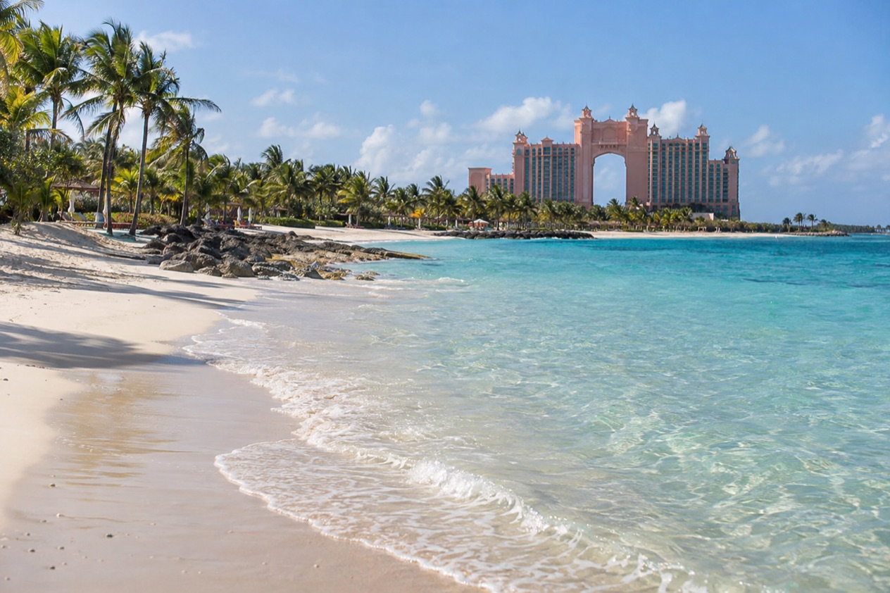
Early in the morning, Nassau Harbour is all engines, gulls and halyards clinking against masts, and the road out of town climbs onto a bridge with the water glittering on both sides. On the far end, the towers of Atlantis catch the first sun and the island’s quiet beach stretches out beyond them. Paradise Island sits just across the harbor from downtown Nassau, and getting there is a matter of choosing a way over the bridges.
How do you get to Paradise Island from Nassau?
You drive or ride over one of two bridges that cross Nassau Harbour, and that is the whole journey. Paradise Island is its own island, yet it is tied to New Providence by those two spans. The first was built in 1966 by Resorts International, and the second followed in the late 1990s.
What decides your way is where you start and how much you want to carry. Arriving at Lynden Pindling International Airport, you are on New Providence, because the island’s own airport closed in 1999 and its old runway is now an 18-hole golf course.
From a downtown hotel or the harbor front, the bridge is simply the next stretch of road. Travelers heading for the resort tend to have luggage, and travelers heading for the beach tend to travel light.
Two other things shape the trip. Drivers in the Bahamas keep to the left side of the road, which matters the moment you take the wheel or sit in the front of a car, and it changes how the bridge approaches feel if you are used to driving on the right. And the licensed jitneys, the small privately run buses, are the budget way over, identified by the route and number on the vehicle.
One thing can cause confusion at the harbor. The high-speed passenger ferry that leaves Nassau in the morning on certain days serves Harbour Island and Spanish Wells, which are other islands entirely. It does not stop at Paradise Island, so there is no ferry to look for here. The crossing is by road, and the two bridges carry everything: resort shuttles, jitneys, private cars and the people heading to the beach for the day.
Once across, the island’s layout is simple. Atlantis dominates the landscape with its hotel towers, its marine habitat and its casino. Marina Village, the beach path and the golf course sit around it. You choose a destination first and the transport second, and the sections below follow that order.
Ways to get to Paradise Island from Nassau
Two practical ways cross the bridges on their own: a jitney or your own car. Both go over the same water and arrive in the same place, so the difference is cost, convenience and how you like to travel. Which suits you depends on your luggage, your plans for the day and your comfort on the left side of the road.
By jitney
Jitneys are the licensed, privately operated buses of Nassau, and rides on them range from $1 to $3. Each carries its route and number on the vehicle, so you match the display to where you want to go rather than waiting for a printed timetable. It is the way many local people move around, and it gives you a look at everyday Nassau along the way.
A jitney suits a traveler with a light bag, plenty of curiosity and a flexible day, such as a beach visit that has no fixed hour. Ask the driver or a fellow passenger if you are unsure the route reaches Paradise Island. The route number on the front is the surest guide, and the drivers are used to questions about where each bus is heading.
By car, on the left
Driving yourself means joining the traffic on the left side of the road and taking one of the two bridges across the harbor. The car gives you freedom to stop where you like and to reach the island’s north shore without depending on a route. It also lets you carry beach gear, a cooler and a change of clothes for the evening.
The car suits travelers who want to combine a morning on the sand with a late lunch and an evening out, all on their own timing. If you are not used to driving on the left, take the first few turns slowly. Roundabouts and junctions near the bridges are where the habit of driving on the right most easily catches people out.
Starting from the airport
Lynden Pindling International Airport in Nassau is where many travelers begin. Air Canada, Alaska Airlines, American Airlines, British Airways, Caribbean Airlines, Copa Airlines, Delta Air Lines and Bahamasair all serve it. From the terminal you reach the bridges by road, so your onward way is the same jitney or car, whichever you pick on arrival.
Because the Paradise Island airport no longer exists, no flight lands on the island itself. Everyone arrives on New Providence first and crosses by bridge. That makes the airport the real starting point for the journey, and the ride to the island the final stretch of the trip.
Options compared
| Option | Best for | What to know |
|---|---|---|
| Jitney | Light luggage and a flexible day | Licensed, privately operated, identified by the route and number displayed on the vehicle |
| Car | Beach gear, a late return, several stops | Drive on the left and cross by one of the two bridges over Nassau Harbour |
| From the airport | Arriving travelers heading to Atlantis or the beach | Paradise Island has no airport, so you land at Lynden Pindling in Nassau and cross by road |
| Harbour ferry from Nassau | Trips to other islands, not Paradise Island | The passenger ferry serves Harbour Island and Spanish Wells, not Paradise Island |
The jitney and the car are the real choice. One is the inexpensive, local way and the other is the independent way, and both use the same bridges. For a single trip to the beach, the jitney keeps things simple. For a day that stretches from morning to the Friday evening show, the car allows you to stay out later and move around the island without watching a route.
Think about the end of the day as well as the start. If you plan to stay for the evening at Marina Village, you will want a way back across the bridge that suits the hour, so settle that when you decide how to come.
Travelers who plan one stop at Atlantis and nothing else can be flexible. Those who plan a full day on the island are better off thinking through the whole round trip.
Making a day of it
A day on Paradise Island can run from the beach to the aquarium to a Junkanoo drum line, all within the island. Start with the water while the morning is quiet and leave the evening for Marina Village. The pieces sit close together, and each is a reason to cross the bridge.
Cabbage Beach in the morning
Cabbage Beach runs about 1.3 miles east from Atlantis along the island’s north shore. It is described as one of the more beautiful beaches on Nassau and Paradise Island, suited to beach walking, swimming or sunbathing. Water-skiing, snorkeling and parasailing are among the activities on offer, so it is a good place if you want to do more than lie on the sand.
Public access is by a path running north from Casino Drive along the east side of the RIU resort. If you arrive by jitney or car, that path is your way to the sand, and it keeps the beach open to anyone who crosses the bridge. Bring a hat and sunscreen, and leave time for a long walk along the shore.
Atlantis, Aquaventure and Dolphin Cay
Atlantis Paradise Island is an ocean-themed casino resort spread over 154 acres, with a waterpark, a marine habitat and several hotel towers. It officially opened in December 1998 with the Royal Towers. Aquaventure, its waterpark, is known for The Current, a lazy river that doubles as a raft ride, and for the Mayan temple slide tower.
Dolphin Cay is a 14-acre marine habitat for manta rays, sea lions and rescued Atlantic bottlenose dolphins. It is presented as one of the largest and most sophisticated dolphin rescue and rehabilitation facilities in the world. The resort also has pools, a beach, restaurants and a walk-in aquarium, so there are rainy-day options if the sky turns gray.
Evening at Marina Village
On Friday and Saturday evenings you can watch a Junkanoo Rush at Marina Village. Junkanoo is the Bahamian street parade of cowbells, goatskin drums, whistles and elaborate paper costumes, and a rush is the moment when the groups surge down the street at full volume. It is a loud, colorful way to close the day.
Plan your return across the bridge with the evening in mind, since the show comes after a full day at the beach. Marina Village also has restaurants and a view of the boats, so you can sit for a while before the drums begin. Arrive in the afternoon, linger over dinner and then watch the rush as the light fades.
Good to know before you go
The U.S. State Department rates the Bahamas Level 2, “Exercise increased caution”, and says most crime occurs in Nassau on New Providence and in Freeport on Grand Bahama.
Pack for sun and sea: a hat, sunscreen and a towel for the beach path. The Atlantic hurricane season runs from June 1 to November 30, so a trip in those months deserves a look at the forecast before you set out. The bridges are the only road link, so a day on the island is easiest when you know how you will cross back.
Sources
- Bahamas Ministry of Tourism, Getting here (https://www.bahamas.com/getting-here), checked October 10, 2026
- Bahamas Ministry of Tourism, Island hopping (https://www.bahamas.com/getting-here/island-hopping), checked October 10, 2026
- Bahamas Ministry of Tourism, Flying to the Bahamas (https://www.bahamas.com/getting-here/flying), checked October 10, 2026
- Wikipedia, Transport in the Bahamas (https://en.wikipedia.org/wiki/Transport_in_the_Bahamas), checked October 10, 2026
- Bahamasair, home (https://www.bahamasair.com/), checked October 10, 2026
- Bahamas Ferries, Your travel (https://bahamasferries.com/your-travel/), checked October 10, 2026
- Bahamas Ferries, FAQ (https://bahamasferries.com/faq/), checked October 10, 2026
- Bahamas Ferries, Our fleet (https://bahamasferries.com/about-us/our-fleet/), checked October 10, 2026
- Bahamas Ferries, Our company (https://bahamasferries.com/about-us/our-company/), checked October 10, 2026
- Lynden Pindling International Airport, Airlines (https://nassaulpia.com/flights/airlines/), checked October 10, 2026
- Wikipedia, Paradise Island (https://en.wikipedia.org/wiki/Paradise_Island), checked October 10, 2026
- Wikivoyage, Paradise Island travel guide (https://en.wikivoyage.org/wiki/Paradise_Island), checked October 10, 2026
- Wikipedia, Atlantis Paradise Island (https://en.wikipedia.org/wiki/Atlantis_Paradise_Island), checked October 10, 2026
- Bahamas Ministry of Tourism, Investments & Aviation (bahamas.com), Cabbage Beach (https://www.bahamas.com/natural-wonders/cabbage-beach), checked October 10, 2026
- Bahamas Ministry of Tourism, Investments & Aviation (bahamas.com), Dolphin Cay (https://www.bahamas.com/natural-wonders/dolphin-cay), checked October 10, 2026
- Wikipedia, Aquaventure (https://en.wikipedia.org/wiki/Aquaventure), checked October 10, 2026
- U.S. Department of State, The Bahamas Travel Advisory, Level 2 (https://travel.state.gov/), checked October 10, 2026
- NOAA National Hurricane Center, Climatology (https://www.nhc.noaa.gov/climo/), checked October 10, 2026
To plan your stay
- Best Time to Visit Paradise Island: Weather by Month, Beach Season, Crowds and Events
- Things to Do in Paradise Island: Atlantis, Cabbage Beach, Junkanoo Rush and Local Food
- Where to Stay in Paradise Island: Atlantis Hotels, Cabbage Beach and the Marina
- Paradise Island vs Cable Beach: Beaches, Resorts, Nightlife and Getting There