
Early in the morning, the check-in line at the Nassau ferry dock fills with travelers carrying beach bags and coolers, all bound for the same long, thin island to the east. Eleuthera rewards the effort of reaching it with pink sand, the cliffs and coves of the Atlantic side, and settlements where the pace is set by the tide. For anyone leaving Miami, the trip is a chain of short connections, and each link changes what the first day looks like.
How do you get to Eleuthera from Miami?
The easiest way runs through Nassau, the gateway of the Bahamas: fly from Miami to the capital, then continue to Eleuthera by a scheduled flight or, for Harbour Island and Spanish Wells, by the fast ferry. Nassau Airport lies about 70 miles in a straight line from Eleuthera, so the second leg is a hop across open water rather than a second long journey.
What decides between the options is where you are sleeping. The Bahamas is an archipelago, and travelers can reach an Out Island either by flying into Nassau first or by flying directly to the island. Eleuthera is long and narrow, and Harbour Island sits off its northern end, reachable only by boat or ferry.
Someone staying on the main island will care about the flight and about having a car at the other end. Someone staying on Harbour Island will care about the ferry timetable and about how the day lines up with its departure.
American Airlines serves Lynden Pindling International Airport in Nassau, which makes it a natural first leg out of Miami. From there, Bahamasair lists a fare from Nassau to North Eleuthera, the airport that serves the northern part of the island.
The ferry, by contrast, sails only on certain days of the week, so the calendar can matter as much as the price. Anyone planning a short stay will want to match the arrival day in Nassau to a sailing day, or choose the plane and skip that constraint.
Once on Eleuthera, the question changes. The island has no public transport system, so visitors generally rent a car to explore it. That shapes the whole trip: the people who see the most of Eleuthera are the ones who plan their ground transportation before they leave Miami, not after they land.
Ways to get to Eleuthera from Miami
By air through Nassau
Flying is the way most travelers will think of first. Scheduled and chartered air service links the Bahamian islands, run by certified domestic and international carriers, and Nassau is the hub where the Miami leg ends and the island leg begins.
American Airlines is one of the carriers at Lynden Pindling International Airport. Bahamasair, the national carrier, lists fares from Nassau to North Eleuthera starting at $80.50, which gives a sense of what the short connection costs.
This option suits travelers heading for the northern settlements or for Harbour Island, who can finish the trip by water from the North Eleuthera side. It also suits anyone who does not want to build the day around a morning ferry. The tip is to treat the Nassau connection as part of one journey: the plane gets you to the island, and the car, or the boat across to Harbour Island, gets you to the bed.
By ferry from Nassau to Spanish Wells and Harbour Island
The high-speed passenger ferry Bo Hengy III runs from Nassau to Spanish Wells and Harbour Island on Wednesdays, Fridays and Saturdays. Check-in runs from 6:45 to 7:45 in the morning, and the boat leaves Nassau at 8:00. It reaches Spanish Wells at 10:10, so it is a morning crossing that puts you on the northern islands before lunch.
Bahamas Ferries accepts same-day ticket purchases if seats are available, with check-in one hour before sailing, but it recommends booking at least two days ahead. The service is cashless and takes credit and debit cards, wire transfers and company cheques.
This route suits people who like arriving by sea and who are staying on Harbour Island or in Spanish Wells, the two passenger destinations. It does not serve the rest of Eleuthera for passengers.
A private ferry charter
For a party of six, Bahamas Ferries can provide a charter to Eleuthera. The idea suits a family or a group of friends who would rather set their own day than follow the sailing days of the scheduled boat. Details and arrangements go through the company, which gives [email protected] as the address to write to.
A charter changes the mood of the trip. Instead of a boat full of strangers at dawn, the crossing becomes part of the vacation itself, with your own group aboard and your own timing. It makes the most sense for those traveling together who also want the freedom to arrive on a day the regular ferry does not sail.
The rental car once you land
On the main island of Eleuthera there is no public transport system, so visitors generally rent a car. The island is about 110 miles long and little more than a mile wide at its narrowest, so the roads trace a ribbon of land with the Atlantic on one side and the Bight of Eleuthera on the other. Drivers in the Bahamas keep to the left side of the road, which is worth remembering before you pull out of the airport lot.
A car turns the long, narrow shape of the island into an advantage. You can drive from one settlement to the next, stopping where the views open up, and the Glass Window Bridge is the clearest example: the Atlantic on one side and the Bight on the other, divided by a strip of rock just 30 feet wide. Harbour Island is a separate matter, since it is reached only by boat or ferry.
Options compared
| Option | Time each way | Best for | What to know |
|---|---|---|---|
| Scheduled flight from Nassau to North Eleuthera | Set by the airline’s schedule | Northern Eleuthera and Harbour Island | Fare from Nassau starts at $80.50 |
| Passenger ferry from Nassau | Leaves 8:00 a.m., reaches Spanish Wells 10:10 a.m. | Harbour Island and Spanish Wells | Sails Wednesdays, Fridays and Saturdays |
| Private ferry charter | Arranged with the company | A party of six | Booked through Bahamas Ferries by email |
| Rental car on the island | Your own pace along a long, narrow island | Exploring beyond one settlement | No public transport on Eleuthera, and traffic keeps left |
You can feel the trade-off between freedom and island mood. The plane is the most flexible link, since it does not depend on a sailing day, and it is the one to choose when the plan is tight. The ferry is the slower, more scenic arrival, but it commits you to a morning departure from Nassau and to a day of the week.
For many trips the best answer is a mix. Take the plane in one direction and the boat in the other, or fly to the main island and then add Harbour Island by water. The charter fits groups that want to ignore the timetable altogether. Whichever way you go, the car is what unlocks the main island, because without it the beaches, coves and settlements stay out of reach.
Think too about how the first and last days fit together. Arriving by the morning ferry puts you in Spanish Wells before lunch and leaves the afternoon free. Arriving by air gives more room to choose the hour, but still asks you to line up the Miami and Nassau legs. Whichever is chosen, remember that the same constraint applies on the way home.
Making a day of it
Eleuthera is the kind of island where the journey and the destination blur. The wide, rolling pink sand beaches and the large outcrops of ancient coral reef are what draw people, and a car lets you work through them at your own speed. A day on the island begins naturally with the coastline, which runs for 210 miles and offers plenty of places to stop.
Glass Window Bridge
The Glass Window Bridge is the most dramatic stop on the main island. Here the Atlantic Ocean and the Bight of Eleuthera are separated by a strip of rock just 30 feet wide, and you see the deep Atlantic on one side and the sheltered Bight on the other. The contrast is obvious from the road, and it explains why so many drivers pull over.
It is a place for photographs and a few quiet minutes rather than a long visit. Pair it with a drive along the island’s length, because the bridge makes the narrowness of Eleuthera real in a way a map does not.
Governor’s Harbour
Governor’s Harbour is a principal settlement and administrative center of Eleuthera. It was established by William Sayle and the Eleutherian Adventurers in 1648, and it lays claim to being the beginning of the post-Lucayan Bahamas. That history gives the town a sense of weight, and a stroll here is a good way to understand how the island has been settled.
Gregory Town, farther along, is home to the annual Pineapple Festival, a reminder that the island has its own calendar of local celebrations. A day spent moving between these settlements is as much about people and stories as about scenery.
Harbour Island and its pink beach
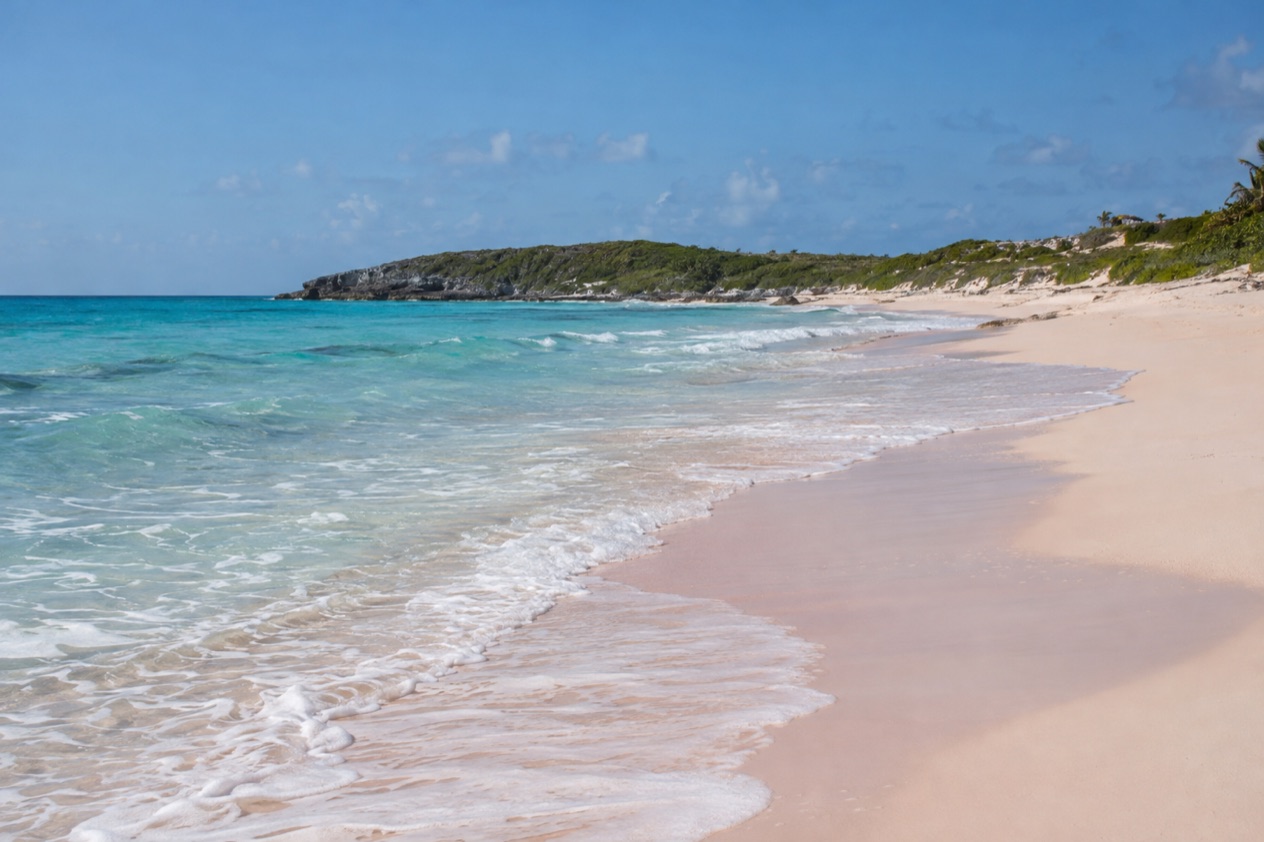
Harbour Island, reached only by boat or ferry, has a beach three miles long with pink sand and clear water. Travel magazines have often cited it as one of the most beautiful beaches in the world. It makes a fine reason to take the ferry, and a day here pairs well with the morning crossing from Nassau.
Bring what suits a beach day, and leave room for walking, since the island rewards slow exploration. Whether you stay a night or longer depends on your schedule, but the ferry days and the flight schedule are what set the limits.
Good to know before you go
The U.S. State Department rates the Bahamas Level 2, “Exercise increased caution”, and says most crime occurs in Nassau on New Providence and in Freeport on Grand Bahama.
The Atlantic hurricane season runs from June 1 to November 30, so plans made for those months should allow room for a change of schedule on a flight or a ferry. The ferry is cashless and takes cards, which is useful to know before you leave Miami. Keep your arrangements for the rental car and for the crossing to Harbour Island in mind from the start, because on Eleuthera the ground transportation is something you organize yourself.
Sources
- Bahamas Ministry of Tourism, Getting here (https://www.bahamas.com/getting-here), checked October 10, 2026
- Bahamas Ministry of Tourism, Island hopping (https://www.bahamas.com/getting-here/island-hopping), checked October 10, 2026
- Bahamas Ministry of Tourism, Flying to the Bahamas (https://www.bahamas.com/getting-here/flying), checked October 10, 2026
- Wikipedia, Transport in the Bahamas (https://en.wikipedia.org/wiki/Transport_in_the_Bahamas), checked October 10, 2026
- Bahamasair, home (https://www.bahamasair.com/), checked October 10, 2026
- Bahamas Ferries, Your travel (https://bahamasferries.com/your-travel/), checked October 10, 2026
- Bahamas Ferries, FAQ (https://bahamasferries.com/faq/), checked October 10, 2026
- Bahamas Ferries, Our fleet (https://bahamasferries.com/about-us/our-fleet/), checked October 10, 2026
- Bahamas Ferries, Our company (https://bahamasferries.com/about-us/our-company/), checked October 10, 2026
- Lynden Pindling International Airport, Airlines (https://nassaulpia.com/flights/airlines/), checked October 10, 2026
- Bahamas Ministry of Tourism, Investments & Aviation (bahamas.com), Eleuthera and Harbour Island (https://www.bahamas.com/islands/eleuthera-harbour-island), checked October 10, 2026
- Wikipedia, Eleuthera (https://en.wikipedia.org/wiki/Eleuthera), checked October 10, 2026
- Wikivoyage, Eleuthera travel guide (https://en.wikivoyage.org/wiki/Eleuthera), checked October 10, 2026
- Wikipedia, Governor's Harbour (https://en.wikipedia.org/wiki/Governor%27s_Harbour), checked October 10, 2026
- Bahamas Ministry of Tourism, Investments & Aviation (bahamas.com), Glass Window Bridge (https://www.bahamas.com/natural-wonders/glass-window-bridge), checked October 10, 2026
- Great-circle distance computed from the GPS coordinates of the two places, October 10, 2026
- U.S. Department of State, The Bahamas Travel Advisory, Level 2 (https://travel.state.gov/), checked October 10, 2026
- NOAA National Hurricane Center, Climatology (https://www.nhc.noaa.gov/climo/), checked October 10, 2026
To plan your stay
- Best Time to Visit Eleuthera: Weather, Sea Temperatures, Seasons and Festivals
- Things to Do in Eleuthera: Pink Sand Beaches, Glass Window Bridge, Queen's Baths and Harbour Island
- Where to Stay in Eleuthera: Harbour Island, Governor's Harbour, Gregory Town and the South
- Know Before You Go to Eleuthera: Entry Rules, Cash, Driving on the Left and Island Etiquette