
Samaria Gorge is a one-way walk of roughly 10 miles (16 km) through a canyon in the White Mountains of southwest Crete, ending on the shore of the Libyan Sea. No road reaches the bottom, so the day ends with a ferry and a bus, and the round trip from Chania takes at least 12 hours. Go in spring if you can, start early, and check the park's official notice before you set out.
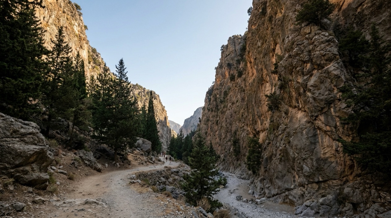
What is Samaria Gorge, and what will you see?
A small café and the Samaria Natural History Museum sit by the parking area. From there the path drops hard, down a stone stairway with wooden rails that winds through cypress and pine. For the first few miles the gorge stays wide and wooded, with plenty of shade and springs where you can refill your bottle.
Roughly halfway down, about three hours in, you reach the abandoned village of Samaria. It has old houses, shade trees and a good spot to sit. The last villagers moved away in 1962, when the gorge became a national park, a step taken largely to shelter the rare Cretan wild goat called the kri-kri. If you're lucky, one wanders past.
Below the village the landscape dries out and the slope eases. The trail follows the riverbed and crosses it on small wooden bridges. Then the cliffs rise on both sides and the rocks underfoot get rougher.
Next come the Iron Gates, the gorge's famous narrows. The walls close in to about 13 feet (4 m) apart and tower some 1,000 to 1,600 feet (300 to 1,640 feet (500 m)) overhead.
A little past the Gates you leave the park at an exit checkpoint, where stands sell fresh orange juice, coffee and cold drinks. From there it's another 1 to 2 miles (1.5 to 1.9 miles (3 km)) to the seaside village of Agia Roumeli, on foot or by shuttle. The village has restaurants and cafés, a beach for a swim and the dock where the ferries wait.
How hard is the Samaria Gorge hike?
It is rated moderate, and it can still be strenuous. The trail is long and mostly downhill, and few stretches are truly flat. The rocky surface works on your feet and knees for hours. If you aren't regularly active, it may be too much, and summer heat makes it harder. Tour operators advise against it for anyone with knee trouble, high blood pressure, heart or lung problems, vertigo or a pregnancy.
Most people walk for 5 to 7 hours, depending on pace and stops, and fast hikers finish in about four and a half. Forest guards with radios patrol the route, and a doctor is stationed at the abandoned village. Rest areas and drinking water points are found at several spots along the route, and many hikers plan their breaks around them. If the first hour already feels like too much, stop there: guards with donkeys can take you back to the start.
Strong hikers can walk the gorge in reverse, uphill all the way. For a shorter outing, start at Agia Roumeli, follow the stream up to the Iron Gates and return the same way. That shows you the lower gorge, though not the full crossing.
When is the best time to hike Samaria Gorge?
The park is open from about early May to late October, and the authorities set the exact dates each year. Spring is the most rewarding time to go. Spring tends to be milder, the plants look lovely and the springs usually run fuller. Peak summer brings heat and around 1,000 walkers a day, which makes the hike less pleasant.
Whatever the month, start early to stay ahead of the heat and the tour groups. A night at Omalos makes that easy. If you start late, plan on a night in Agia Roumeli.
How do you buy tickets, and when is it open?
Entry is ticketed. You can buy online in advance through the official NECCA platform or at the entrance. Keep your ticket handy, since it may be checked at the exit.
Opening dates and daily admission hours are announced each year. Entry for the full crossing closes in the afternoon. If you're heading back the same day, set your start time by counting back from the last ferry out of Agia Roumeli.
How do you get to Samaria Gorge?
Driving isn't practical, because the trail runs one way and your car would be waiting back at Omalos. The bus or a tour is easier.
In Chania, the main bus station is a short walk from the Old Town, and the KTEL bus company can arrange transport to the gorge. The buses leave early in the morning for the plateau of Omalos, where the trail begins. At the Chania station you can buy a round-trip bus ticket and your ferry ticket together. Buy ahead to get the departure you want, and check the current schedule on the official KTEL website. You can also reach the trailhead by bus from Palaiochora or Sougia.
At the bottom, ferries from Agia Roumeli head east to Chora Sfakion or west to Sougia and Paleochora, and you choose the direction when you buy your ticket. Buses meet the boats at Chora Sfakion and Sougia for the ride back to Chania. Expect about an hour on the boat and an hour and a half on the bus, which gets you back to Chania in the evening. Ferry and bus schedules change with the season, so confirm both before you go.
Travel agencies in Chania, Rethymno and other towns in western Crete sell full-day excursions with hotel pickup and all transport included. They cost a little more than going on your own, but they take care of the transport for you.
What should you bring?
Wear sturdy, comfortable hiking shoes, because flip-flops and sandals are a bad idea on those rocks. Bring sunscreen, a hat and sunglasses, and consider trekking poles for the descent.
Springs along the trail provide drinking water, so many hikers carry just a small bottle each. Toward the end of summer some springs can run dry, so in the hot months carry at least 3 liters per person. There is no food along the trail itself, so pack a sandwich, fruit or energy bars to carry with you. Bring a swimsuit and towel for the beach at Agia Roumeli, where a swim feels wonderful after the hike.
What can you pair it with nearby?
Chania is the natural base, and its old harbor with the Egyptian lighthouse is a fine place to spend the evening after the hike. Chora Sfakion is a boat gateway to Loutro, Sougia and other beaches on the Libyan Sea. Boats from Paleochora or Chora Sfakion also reach Gavdos, the southernmost point of Europe. Lake Kournas, 47 km (about 29 miles) from Chania, is usually billed as Crete's only natural lake. Rethymno, the island's third largest city, lies about 37 miles (60 km) east of Chania, and KTEL runs buses between the two.
Sources
- panoramictales.com (https://www.panoramictales.com/en/post/samaria-gorge-crete-greece), checked October 18, 2026
- greeka.com (https://www.greeka.com/crete/chania/sightseeing/samaria-gorge/), checked October 18, 2026
- fantasytravelofgreece.com (https://www.fantasytravelofgreece.com/tours-in-greece/samaria-gorge-hiking), checked October 18, 2026
- cretanbeaches.com (https://www.cretanbeaches.com/en/gorges-and-canyons-in-crete/west-crete-gorges-chania/samaria-gorge), checked October 18, 2026
- travel.usnews.com (https://travel.usnews.com/Crete_Greece/Things_To_Do/Samaria_Gorge_National_Park_62805/), checked October 18, 2026
- e-ktel.com (https://www.e-ktel.com/en/), checked October 15, 2026
- Visit Greece (GNTO) (https://www.visitgreece.gr/en/islands/crete/chania), checked October 15, 2026
- minoan.it (https://www.minoan.it/en/11-uncategorized/165-timetable-ferry-piraeus-chania), checked October 15, 2026
- anek.gr (https://www.anek.gr/en-gb/destinations/chania), checked October 15, 2026
- Hellenic Ministry of Culture, Odysseus (http://odysseus.culture.gr/h/1/eh155.jsp?obj_id=16001), checked October 15, 2026
- Hellenic Ministry of Culture, Odysseus (http://odysseus.culture.gr/h/3/eh355.jsp?obj_id=15825), checked October 15, 2026
To plan your stay
- Best Time to Visit Greece: September and Late May to Early June
- Arachova: Parnassus Mountain Town, Formaela Cheese, Ski Season and Saint George's Day
- American Airlines Flights to Greece: U.S. Cities, Athens Arrivals and Onward Island Flights
- Greece on a Budget: Cash Machines, Cards, Beaches and Ferries