
You come down toward Vlychada Beach on Santorini and the landscape changes from the vineyards and white villages of the postcards into something stranger, with pale, wind-carved walls rising behind a shore that looks nothing like a resort. Fishing boats rock in the little harbor, the Aegean fills the horizon, and the ground itself reminds you that this island is the rim of a volcano.
Is visiting Vlychada Beach worth it?
Yes, if you come to Santorini for its volcanic character and not only for sunset views, Vlychada Beach is a rewarding stop, especially for photographers, walkers and anyone curious about how the island was made.
What sets it apart from the other beaches on Santorini is the scenery behind the water. Beaches across the island have sand or pebbles made of solidified lava in different colors, with the Red Beach, the Black Beach and the White Beach the best known names. Vlychada belongs to that volcanic family, but its signature is the bare, eroded cliff that stands over the shore, a landscape often compared to the surface of the moon.
The island receives an estimated two million visitors a year, and most of them head for the caldera rim. A beach like this one gives you the other half of the story: the outer coast, the harbor life and the raw material that the eruptions left behind. It is a place to look at things, to walk, to sit with a book and to watch the light change on stone.
What to see at Vlychada Beach
The sculpted cliffs
The first thing that holds your eye is the cliff itself. Volcanic ash and pumice, laid down in layers during the island’s eruptions, have been worked by wind and rain into walls, towers and hollows in cream and gray tones. In places the surface looks smooth, in others it is cut into ribs and channels, and the shapes seem to change as you walk along the base.
Look closely at the layers. Each band is a record of a different moment in the island’s past, and you can follow them for long stretches.
The shoreline and the small harbor
At the water’s edge the mood is gentler. A small harbor shelters fishing boats and a few pleasure craft, and the sound is one of ropes, engines and gulls. Seaside tavernas near harbors on the Greek islands usually serve grilled fish, octopus, fava (a purée of yellow split peas, a Santorini specialty) and cold salads, and the same mix is what you should look for here.
The Aegean stretches out ahead with no caldera wall in the view, which is itself a change for anyone who has spent days looking at the inner rim. On a clear day the horizon is wide and empty, and the shoreline feels more like the edge of an island than the edge of a volcano.
The volcano that explains it all
Santorini is the largest island of a small, circular archipelago formed by the caldera, and the inner coast there is a sheer precipice of more than 980 feet at its highest. Vlychada sits on the outer side of that story, where the slopes of the old volcano ran down to the sea and where eruption deposits still make up the land.
Santorini has an active volcano, and visitors can stay in its caldera. Standing at Vlychada, with ash-colored walls behind you, you can picture the scale of what happened here.
Ancient Thera and Akrotiri elsewhere on the island
Santorini was known in ancient times as Thera, and two sites tell that older story. Excavations at Akrotiri have uncovered a major Minoan town with multi-level buildings, streets and squares, with walls standing as high as eight metres. Ancient Thera was founded on Mesa Vouno, 1,299 feet above sea level.
Neither site is on the beach, but both give meaning to what you see at Vlychada. The volcano that carved the cliffs also buried the Bronze Age town, and visiting the ruins and then the shoreline lets you see both the human story and the natural one.
Hours, tickets and rules
Vlychada Beach is a stretch of coast on an island of about 15,480 people, and what you do there is shaped by the sea, the wind and the cliffs rather than by a timetable. The ruins elsewhere on Santorini, such as Akrotiri, run on their own schedules, but the shoreline is a different kind of visit, one measured in light and weather.
The one seasonal force to know about is the meltemi, a strong, dry north wind of the Aegean Sea that blows periodically from about mid-May to mid-September. On an Aegean island it can change how a day on the shore feels, from the sound of the wind to the movement of the water, so a day at the beach in those months is worth planning with the forecast in mind.
Beyond the wind, the best habits are the usual ones at any volcanic shoreline. Take your rubbish with you, treat the cliff faces as they are, and enjoy the layered stone from a respectful distance, since the loose material is part of what makes the scenery.
How to get to Vlychada Beach
Getting to Vlychada starts with getting to Santorini, and there are two ways to reach the island. Santorini is connected by ferry with Piraeus on a daily basis all year long, with up to 5 direct crossings during summer. The island lies about 120 miles southeast of the mainland, in the southern Aegean Sea.
By air, Santorini Airport lies about 4 miles southeast of downtown Thera, and its main asphalt runway is 6,972 feet long. Arriving by plane puts you on the island within reach of any base you choose, whether that is Fira, Oia or a village near the coast.
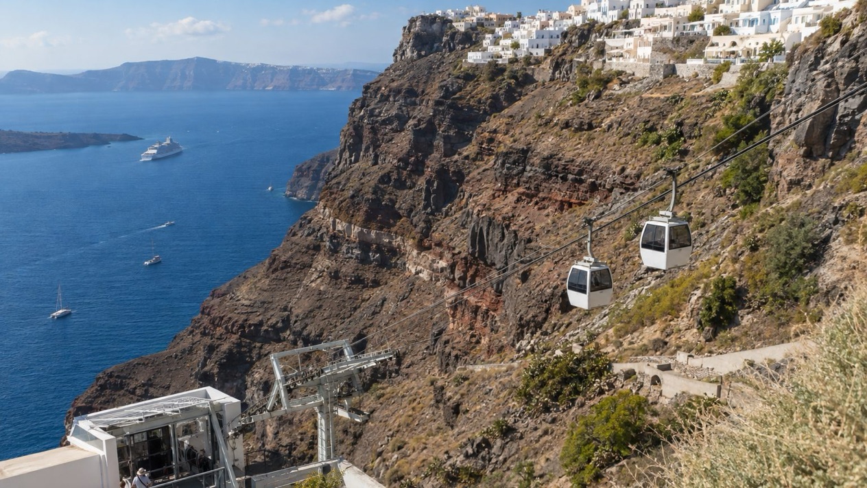
Cruise passengers arrive differently. Ships anchor off Skala, the old port of Santorini, and passengers are transferred by local boatmen to shore, where Fira is accessed by cable car, on foot, or by donkeys and mules. From Fira, you continue across the island to the shore of your choice.
From there, plan the last stretch on the island itself. Whichever base you pick, look at a map before you leave and decide how you will get to the shoreline and back, since the beach is on its own part of the coast rather than next to the caldera villages.
When to visit Vlychada Beach
Summer is the season for the water, and the cooler months are the season for the scenery. In July, Santorini is hot and almost completely dry, which suits swimming and sunbathing but also brings the meltemi, which blows from about mid-May to mid-September.
| Month | Average high (°F) | Average low (°F) | Precipitation (inches) | Days with rain (1 mm or more) |
|---|---|---|---|---|
| January | 57.9 | 49.8 | 2.37 | 10.3 |
| April | 66.0 | 55.9 | 0.63 | 3.6 |
| July | 85.5 | 73.9 | 0.01 | 0.1 |
| October | 73.6 | 63.9 | 0.94 | 3.8 |
April and October sit between the extremes. October is warm enough to enjoy the shoreline and sit outside at a taverna, and the days are shorter than in summer.
January is a different trip. Rain falls on about ten days of the month, so a rain jacket and warm layers belong in the bag. In that season the shoreline is for walking and photographing, and it is a month to pair with indoor stops and long meals rather than a day on the sand.
Summer demands sun protection, since the high averages in July are in the mid-80s. Over the whole season, the island sees an estimated two million visitors, so if you want the shoreline to feel less like a stop on a circuit, choose the months on either side of the hottest weeks.
Tips for your visit
Bring what you would for any volcanic coast. Sturdy shoes help on loose ground, sun protection matters in the warm months, and a layer is useful when the wind picks up. Water and a hat are sensible additions in summer, when the average high reaches the mid-80s and the rain almost never falls.
Combine the shoreline with the island’s deeper story. A day that includes the cliffs at Vlychada and the Minoan town at Akrotiri gives you both the geology and the people who lived through it. Ancient Thera, on Mesa Vouno at 1,299 feet above sea level, adds the later Hellenic city to the same picture.
For a more relaxed day, pair the beach with a meal at the harbor and a slow walk along the water. Santorini’s cooking leans on local produce, so look for fava, tomato fritters, capers, grilled fish and the island’s white wines, and let lunch set the pace of the afternoon.
Families and travelers with limited mobility should think about the ground before they commit. A volcanic shoreline has loose stone and uneven footing, and the cliffs are best admired from where you stand. Decide how far you want to walk and let the weather help you choose the day.
Good to know before you go
Greece uses the euro, and cards and cash are both part of daily life on the island, though a few coins are handy for small harbor stops. Keep the meltemi in mind from mid-May to mid-September, when the north wind can shape the day on an Aegean shoreline, and bring water and sun protection for the hotter months. The rest is common sense on a volcanic coast: watch your footing, enjoy the cliffs from a distance and leave the place as you found it.
Sources
- Wikipedia, Santorini (https://en.wikipedia.org/wiki/Santorini), checked October 12, 2026
- Santorini official guide (https://www.santorini.gr/), checked October 12, 2026
- Visit Greece (GNTO), Santorini (https://www.visitgreece.gr/islands/cyclades/santorini/), checked October 12, 2026
- Hellenic National Meteorological Service (HNMS), climatological normals 1991-2020 for Santorini station (https://www.emy.gr/climatic-data), monthly mean daily maximum and minimum; rain from the ECMWF ERA5 reanalysis, 1991-2020, grid cell of Santorini (Open-Meteo), checked October 12, 2026
- ECMWF ERA5 reanalysis 1991-2020, grid cell of Santorini (Open-Meteo), checked October 12, 2026
- Wikipedia, Blue Flag beach (https://en.wikipedia.org/wiki/Blue_Flag_beach), checked October 12, 2026
- Wikipedia, Meltemi (https://en.wikipedia.org/wiki/Meltemi), checked October 12, 2026
To plan your stay
- Agia Marina Beach near Chania: Setting, Seasons and the Old Town Next Door
- The Beaches of Antiparos: Sandy Shores, Nudist Coves, the Cave and Despotiko
- Agios Gordios Beach on Corfu: Ai Gordis Village, the Pink Palace, Weather by Season and Tips
- Agios Prokopios Beach: Naxos Setting, Seasons, Food and Nearby Sights