
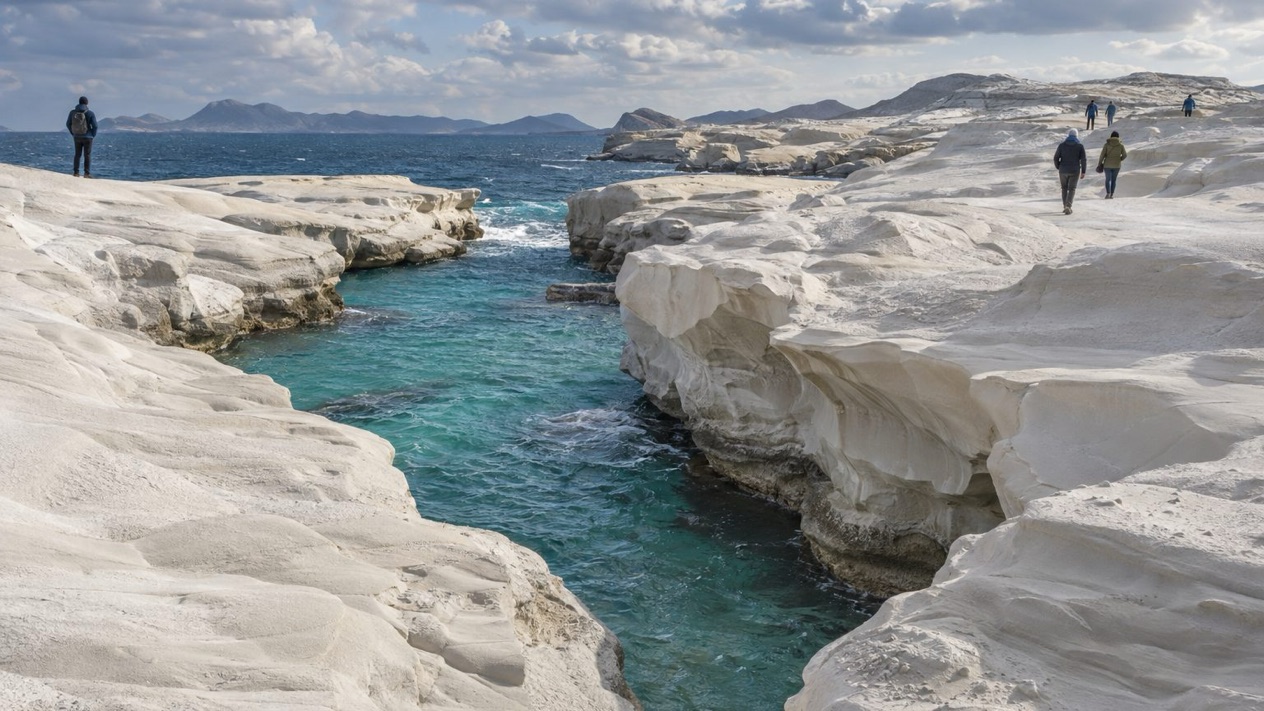
Tsigrado is a cove that you feel before you see it: rock walls close in, the sound of the sea carries up from below, and a patch of water appears between the cliffs. The stone around it is volcanic, the kind of landscape Milos is built from.
Is visiting Tsigrado Beach worth it?
Yes, if you came to Milos for its coastline rather than for a resort, and if a cove carved out of volcanic rock sounds more appealing than a long, organized stretch of sand.
What sets it apart from similar places nearby is the setting. Milos is a volcanic island, the southwesternmost of the Cyclades, and its shoreline shows it in white, gray and rust-colored rock that changes from one bay to the next.
Tsigrado belongs to that family of coves, a place where the cliffs are as much of the picture as the water. The island has over 70 beaches, so the choice is large, and each one has its own character. Some are broad and easy to settle into. Tsigrado is the sort you pick for its landscape.
Milos is also described as a less crowded setting than Santorini and Mykonos, which is part of why travelers who have already seen the famous Cycladic postcards come here. A day at Tsigrado fits that mood: you look at rock, sea and sky, and the island does the rest. It is a summer destination, and the beaches are the main reason people come in those months.
Think of Tsigrado as one stop in a larger island circuit rather than the whole plan. Milos has a harbor town, hot springs, white rock formations and a famous statue story, and a beach day sits comfortably among them. If your idea of a good beach is a lounge chair and a menu, look at other bays on the island. If it is cliffs and volcanic stone, Tsigrado belongs on your list.
What to see at Tsigrado Beach
The cove and its cliffs
The cove is the whole point. Rock rises on the sides and frames the sea, and the stone shows the island’s volcanic origin in its colors and textures. Look at the way the cliff faces are layered and weathered, because that is what the wind and water have been working on for a very long time.
The sea itself is the other half of the view. Depending on the light and the day, the water shifts between deep blue and paler shades near the edge. Bring a camera if you like landscapes, since the cliffs make a natural frame.
A volcanic island under your feet
Milos is considered a dormant volcano that could erupt again, and the island’s whole shape comes from that history. Its highest point is Mount Profitis Elias at 2,454 feet, in the west. The island measures about 14 miles from east to west and 8.1 miles from north to south, so it is large enough to hold very different coastlines.
Tsigrado is one expression of that geology. When you stand in the cove, you are looking at the same family of rock you will see across the island, from the harbor to the headlands. Seeing that continuity is part of the pleasure of a day spent on Milos rather than on a flat island with a single type of beach.
Sarakiniko and the white rock
Sarakiniko is the coastal area on Milos known for its white rock formations shaped by wind and water erosion. It makes a striking contrast with the darker volcanic walls of a cove like Tsigrado, and seeing both on the same trip shows how varied the coastline is.
The white stone looks almost like a pale moonscape against the sea. If you are planning more than one beach stop, this is the landscape people pair with a cove day. The shapes in the rock were made by erosion rather than by anyone’s hand, and they reward a slow walk and a good look.
Adamantas and the hot springs
Adamantas is the harbor town of Milos, and it is where many visits begin and end. On the eastern shore of the harbour there are hot sulfurous springs, one more sign of the volcanic activity beneath the island. They make a different kind of stop from a beach, and a useful reminder of what lies under the sand and stone.
The harbor is also the place to look for a meal after a beach day. Grilled fish, salads with feta, and the island’s other simple Greek dishes are what you find in a seaside taverna, the kind of meal that suits a day outdoors. Milos has traditional Greek architecture, and the waterfront is a good place to see it.
The Venus de Milo story
The statue of Aphrodite known as the Venus de Milo was unearthed on Milos and is now exhibited at the Louvre Museum in Paris. The island is famous for it, even though the statue itself is far away.
Keep it in mind as you travel around. Visitors enjoy connecting the beach days with the island’s cultural story, and Milos makes it possible to do both within a small area. A beach morning, a harbor lunch and the story of the statue make a well-rounded day.
When to visit Tsigrado Beach
The best months for a beach day are the warm ones, and Milos is a popular tourist destination during the summer. At Santorini, close to Milos, July highs reach the mid-80s, which is the heat of a proper beach holiday, and the sea is where you want to be. Rain is almost absent that month, so the weather rarely interferes with a plan.
The meltemi is a strong, dry north wind of the Aegean Sea that blows periodically from about mid-May to mid-September. Milos sits in the Aegean, so a windy day can happen in the summer season. Wind affects how a beach feels and how the sea behaves, so treat it as part of the summer rhythm and keep your plans flexible.
The shoulder months are different. October is still warm, with highs in the low 70s at Santorini, and a few rainy days. April is milder and drier than winter, and January is the wettest of the four months here, with many rainy days. A beach swim is a summer idea, while the cooler months suit walking and sightseeing along the coast.
| Month | Average high at Santorini (°F) | Average low at Santorini (°F) | Rain days on Milos |
|---|---|---|---|
| January | 57.9 | 49.8 | 11.2 |
| April | 66.0 | 55.9 | 3.5 |
| July | 85.5 | 73.9 | 0.3 |
| October | 73.6 | 63.9 | 4.4 |
In July, a cove on volcanic rock is a place of strong sun, so sun protection matters. In January, with so many rainy days, a rain jacket is a better companion than a swimsuit. The mid-year months are the ones that make the beaches the focus of the island.
If you are choosing a month for the whole island rather than for one cove, think about what you want from it. Summer brings the beach days and the busier mood. Spring and autumn bring a gentler pace and more room for exploring the harbor, the white rock and the coast on foot.
Tips for your visit
Bring sun protection, a hat and a water bottle if you go in summer, since the high averages that season make the sun strong. Sturdy shoes suit a rocky cove better than flimsy sandals, because volcanic stone can be rough underfoot. A swimsuit and a towel are the obvious companions, and a camera is worth carrying for the cliffs.
Combine the cove with other parts of the island. Sarakiniko offers a very different landscape of white rock formations, and Adamantas gives you the harbor, a meal and the hot sulfurous springs on its eastern shore. Together they give you a good picture of why Milos draws visitors with its varied coastline and beaches.
With more than 70 beaches on the island, it is worth leaving room in the day for a second or third stop. Some bays suit a long stay, and others a short look. Tsigrado is the one to choose for its scenery, and you can follow it with a beach that offers more in the way of comfort.
- Wear shoes with a good grip for the rocks.
- Bring water and sun protection in summer.
- Pair the cove with Sarakiniko for a contrast in landscapes.
- Finish in Adamantas with a seafood or Greek salad meal.
Families and travelers with limited mobility should look into the details before choosing this cove, because a rocky setting is not the same as a beach with facilities. Other beaches on Milos may suit those needs better, and with so many to choose from, there is a bay for each kind of day.
If the wind blows, pick another bay or spend the day on the island’s other sights. The island is about 14 miles across, so shifting from one coast to another is part of the experience.
Good to know before you go
Milos lies roughly midway between Piraeus and Crete, and the euro is the currency across Greece. Sea conditions depend on the day and on the wind, so look at the water before you swim and keep an eye on your belongings as you would at any beach. The meltemi blows periodically from about mid-May to mid-September and can change how a day on the coast feels, so a flexible plan helps.
Sources
- Wikipedia, Milos (https://en.wikipedia.org/wiki/Milos), checked October 12, 2026
- Visit Greece (GNTO), Milos (https://www.visitgreece.gr/islands/cyclades/milos/), checked October 12, 2026
- Wikivoyage, Milos (https://en.wikivoyage.org/wiki/Milos), checked October 12, 2026
- Hellenic National Meteorological Service (HNMS), climatological normals 1991-2020 for Santorini station (https://www.emy.gr/climatic-data), monthly mean daily maximum and minimum; rain from the ECMWF ERA5 reanalysis, 1991-2020, grid cell of Milos (Open-Meteo), checked October 12, 2026
- ECMWF ERA5 reanalysis 1991-2020, grid cell of Milos (Open-Meteo), checked October 12, 2026
- Wikipedia, Blue Flag beach (https://en.wikipedia.org/wiki/Blue_Flag_beach), checked October 12, 2026
- Wikipedia, Meltemi (https://en.wikipedia.org/wiki/Meltemi), checked October 12, 2026
To plan your stay
- Agia Marina Beach near Chania: Setting, Seasons and the Old Town Next Door
- The Beaches of Antiparos: Sandy Shores, Nudist Coves, the Cave and Despotiko
- Agios Gordios Beach on Corfu: Ai Gordis Village, the Pink Palace, Weather by Season and Tips
- Agios Prokopios Beach: Naxos Setting, Seasons, Food and Nearby Sights