
On the seat-back screen of a long flight, the little plane icon creeps across the Pacific, and sooner or later someone leans over to ask where exactly the country below is. Japan is an island nation off the Pacific coast of Asia, a long chain of islands strung out on the water, with Hokkaido, Honshu, Shikoku, Kyushu and Okinawa as its main islands. Knowing how the chain is laid out, which seas wash it and which countries sit across the water makes every other plan on the map easier to picture.
Where is Japan located?
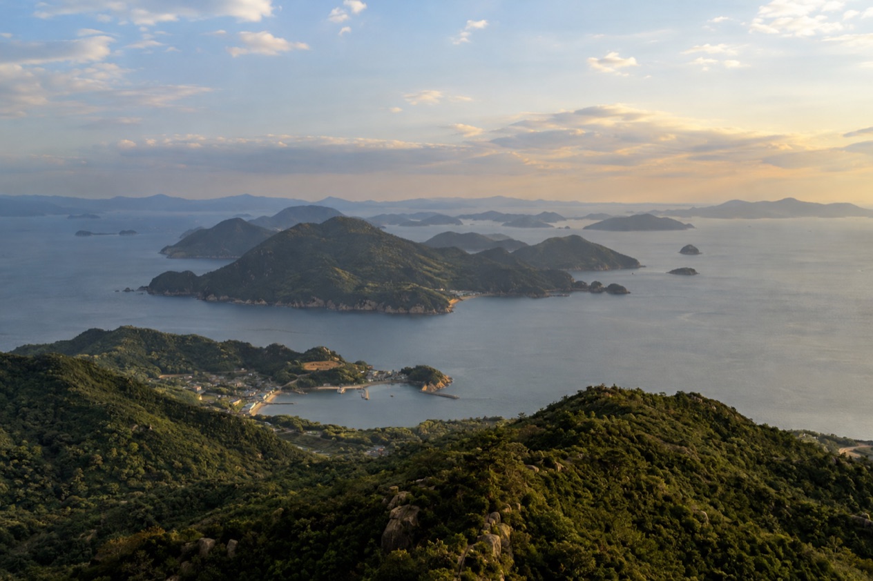
Japan sits along the Pacific coast of Asia, a country made of islands rather than a piece of a continent. The archipelago stretches out into the ocean in a long, curving line, and nowhere does it share a land border with another country. Everything that arrives, from people to freight, comes by air or by sea.
From north to south they run Hokkaido, Honshu, Shikoku, Kyushu and Okinawa. Honshu is the one visitors picture, because Tokyo, Kyoto, Osaka, Nara, Hiroshima and Kanazawa all lie on it, and so does Mount Fuji in Shizuoka Prefecture.
A country of islands, big and small
Beyond the five main islands, the archipelago counts thousands of smaller ones, many of them with names few travelers will ever need. Some are tied to the main islands by bridges and ferries, others sit alone in the water, and each belongs to one of the country’s prefectures, the administrative units that organize the whole map.
For a traveler, this means that distance on a Japanese map is often water. Hokkaido, Shikoku and Kyushu each have their own character, food and landscape, and Okinawa, the southernmost of the main islands, has its own rainy season that begins in early May, well before the rest of the country thinks about summer.
Honshu, Tokyo and the biggest crowds
Honshu holds the Greater Tokyo Area, which had a population of 38,140,000 people in 2016. Haneda Airport in Tokyo is the largest airport in Japan, and it was Asia’s second-busiest airport in 2019. Together they explain why so many trips start on this island, even when the final destination is somewhere else on the map.
The same island carries the postcard image the world associates with the country. Mount Fuji and the Shinkansen are notable features of Japan, and the volcano, dormant since 1707, rises in Shizuoka Prefecture. Lake Biwa, an ancient lake and the country’s largest freshwater lake, also lies on the map of Honshu’s interior, and the Shinano River, the longest in Japan, winds through Nagano and Niigata Prefectures.
Mountains, forests and volcanoes
Japan is far greener than the neon of its cities suggests. The archipelago is mostly forest, with farmland covering a smaller share, and the volcanic ground is part of daily life: the country has 108 active volcanoes, which is also why hot springs turn up in so many regions. Five sites have been inscribed on the UNESCO World Heritage List for their outstanding natural value.
On a trip, this shows in the scenery between cities. Train windows frame wooded ridges, river valleys and the occasional smoking crater, and the places where people gather for onsen baths are often tucked into exactly this kind of terrain.
| Feature | Figure |
|---|---|
| Islands in the archipelago | 14,125 |
| Administrative prefectures | 47 |
| Coastline length | 18,486 miles |
| Active volcanoes | 108 |
| Mount Fuji elevation | 3,776 m |
Which seas surround it?
The Pacific Ocean borders Japan along its long eastern side, while the Sea of Japan lies between the archipelago and the Asian mainland. Other bodies of water complete the picture, among them the Sea of Okhotsk, the East China Sea and the Philippine Sea. With so many islands, the country’s coastline is the sixth longest in the world, at 18,486 miles.
That much shoreline shapes daily life. Fishing ports, harbor towns and ferry terminals are scattered along it, and seafood turns up in almost every regional cuisine, from grilled fish at breakfast to sashimi at an izakaya, the casual pub where small plates arrive one after another.
The Pacific side and the Sea of Japan side
Honshu is a useful place to feel the difference. Tokyo, Yokohama, Nagoya and Osaka face the Pacific side of the country, and Kanazawa belongs to the Sea of Japan side. The two coasts feel like different regions in their food, in their ports and in the way the weather arrives, because the water on each side behaves differently through the year.
A trip that crosses Honshu from one coast to the other therefore changes character along the way. Ramen, local sake and fresh catch vary from town to town, and a traveler who eats along the route tastes the sea each coast has to offer.
Okinawa and the southern waters
Okinawa is the island chain most closely tied to the sea in the minds of travelers. It is the southernmost of the five main islands, and its early-May rainy season marks the start of a long stretch of warm, humid weather. Seasonal weather there follows its own calendar, so a trip to Okinawa is planned separately from one to Tokyo or Kyoto.
Okinawa is also a place where the island food and music feel distinct from the rest of the country. Dishes built on pork, bitter melon and sweet potato, and the sound of the sanshin, a three-stringed instrument covered in snakeskin, give the island an identity that grew out of life on the water.
Typhoons and the surrounding water
The seas also feed the weather. In late summer and early autumn, typhoons often bring heavy rain to Japan, and a traveler planning a trip in those months should expect that a stormy day can reshuffle an itinerary. Flights, ferries and trains can all be affected when a typhoon passes.
Outside those months the same coastline is mostly a backdrop for good eating and long walks. Harbor markets, seaside shrines and fishing villages fill the shore, and the sea itself is a quiet partner to nearly every regional specialty.
Which countries are its neighbors?
Japan has no land neighbors, but across the water lie Russia, South Korea, North Korea, China, Taiwan and the Philippines. The nearest neighbors are all reached by sea or air, since the archipelago shares no land border with any of them.
This is part of why Japan has developed such a distinct culture. Contact with the mainland has always come across open water, through ports and sea lanes, and the country’s language, food and architecture reflect centuries of both exchange and separation.
The neighbors across the Sea of Japan
South Korea, North Korea and Russia face Japan across the Sea of Japan, and China and Taiwan are reached across the East China Sea. For a traveler, the practical meaning is that Japan is a stand-alone destination: a trip here is a trip to the islands, with no road crossing to add on.
Fukuoka on Kyushu and the ports of Honshu’s western coast are the kinds of places where this closeness to the mainland shows up in the food. Noodles, dumplings and grilled meats there carry echoes of the cuisines across the water, and many menus have clearly absorbed those influences.
Taiwan, the Philippines and the southern link
Moving south along the island chain, Okinawa is the point where Japan comes closest to Taiwan and the Philippines. Its culture shows the exchange: the Ryukyu heritage of the islands, with distinct textiles, pottery and music, grew out of centuries of sea trade with its neighbors.
A traveler who reaches Okinawa will find that the cooking, the festivals and even the architecture, such as the red-tiled roofs and stone lion statues called shisa, feel different from Tokyo or Kyoto. The south is a region with its own accent, shaped by the water that connects it to the rest of Asia.
What this means for getting there
Because Japan is surrounded by water, most international visitors arrive by air. Haneda Airport in Tokyo is the largest airport in Japan, and it handled enough traffic in 2019 to rank as Asia’s second-busiest. Many trips begin there and spread out to the rest of the archipelago afterward.
Once on the ground, the Shinkansen, the high-speed rail network that is one of the notable features of Japan, links the main cities of Honshu with other parts of the country. The map of the archipelago, with its long curve of islands, becomes easier to read once the train routes are laid over it.
Good to know before you go
Japan is far from the United States and spread over a long chain of islands, so a trip rewards a clear sense of the map before the first flight. Prices are in yen, and a traveler who treats each island and region as its own destination will find the country easier to enjoy. Late summer and early autumn are the months when typhoons often bring heavy rain, and Okinawa’s own rainy season begins in early May, so the calendar matters as much as the map.
Sources
- Wikipedia, Geography of Japan (https://en.wikipedia.org/wiki/Geography_of_Japan), checked October 11, 2026
- Wikipedia, Japan (https://en.wikipedia.org/wiki/Japan), checked October 11, 2026
To plan your stay
- Best Time to Visit Japan: Cherry Blossoms, Autumn Colors, Weather and Festivals
- Where to Stay in Japan: Ryokan, Temple Stays, Capsule Hotels and the Best Cities to Base In
- Sending Luggage from the Airport in Japan: Hands-Free Travel, Hotel Delivery and Coin Lockers
- Know Before You Go to Japan: Entry, Money, Etiquette and Getting Around