
The road ends where the land narrows into a tongue of forest and mountain pushed out into the Sea of Okhotsk, and the first thing you notice is how little has been built on it. Steam rises from a river that runs warm, brown bears work the streams, and across the water lies an island that two countries both claim. Shiretoko is a park for travelers who want Hokkaido at its most untamed, and it rewards slow looking more than a checklist.
Is visiting Shiretoko National Park worth it?
Yes, if you come for landscape, wildlife and a sense of the edge of the map rather than for temples, shopping or a packed sightseeing schedule. It suits people who like to read a place slowly: a walk beside a steaming stream, a view across the strait, a soak in a hot spring after a day outdoors.
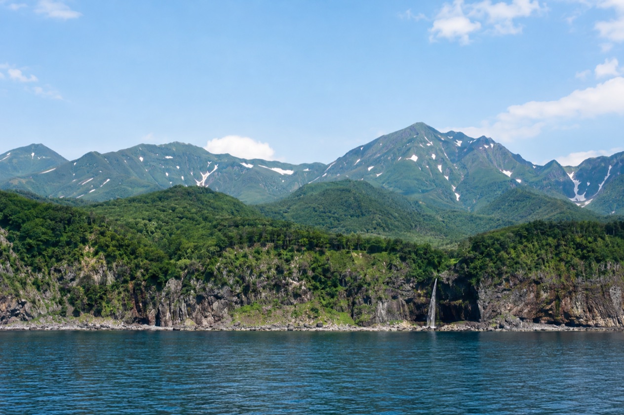
The park covers the entire Shiretoko Peninsula, at the northeastern tip of Hokkaido, and the Ministry of the Environment of Japan governs it. That alone sets it apart from the busier national parks of Honshu, where trails and temples share the same hillsides. Here the story is the ecosystem itself, and the peninsula is accessible only on foot or by boat, which tells you what kind of place it is.
What gives Shiretoko its standing is the way sea and land feed each other. The peninsula was registered as a UNESCO World Heritage Site in 2005, in recognition of being the southernmost point where sea ice usually forms in the Northern Hemisphere.
That ice carries nutrients that start a food chain running from plankton to fish, then to eagles, seals and bears. Japan’s largest population of brown bears lives here, and the salmon streams are part of why.
Compared with other Hokkaido destinations, Shiretoko trades convenience for atmosphere. You will not find the ski-resort buzz of Niseko or the city energy of Sapporo. You get a protected landscape that feels like a frontier, a hot springs waterfall with a name from the Ainu language, and a quiet fishing-town base at Rausu where the baths cost nothing.
What to see at Shiretoko National Park
The park is less a set of monuments than a handful of places that each show a different side of the peninsula: a waterfall warmed from below, a high volcanic ridge, a visitor center that explains the ecosystem, and a view of a contested island. Together they give a fair picture of why the area was protected.
Kamuiwakka Falls
Kamuiwakka Falls is a hot springs waterfall, which means the water that tumbles down the rock is warmed by volcanic heat rather than by the sun. The name comes from the Ainu language and means water of the gods, a phrase that suits a stream steaming in the middle of a cool forest. The Ainu, the Indigenous people of Hokkaido, have long given the peninsula’s features names that describe what they are and what they mean.
What you see is a cascade of mineral-stained rock, wisps of vapor and green forest pressing in on all sides. It is the kind of place where you stop talking and listen to the water. Whether you can wade, bathe or walk beside the stream is a question of current access and rules, so treat it as a place to look at and photograph unless you have confirmed otherwise on the spot.
Mount Rausu and the spine of the peninsula
Mount Rausu is the highest peak on the Shiretoko Peninsula, at 5,449 feet. It belongs to the volcanic chain that runs down the middle of the peninsula like a spine, and its slopes feed the streams and forests below. Seen from the coast, the ridge makes the peninsula look even narrower and more rugged than the map suggests.
The mountains are why the park feels so complete: sea at the edge, forest in the middle, high ground above. Bears move between these zones following food, and the same slopes shape the weather that rolls in off the water. For visitors the mountain is something to admire from lower ground and to understand as the backbone of the whole park.
Shiretoko Park Nature Center in Shari
The Shiretoko Park Nature Center in Shari serves as the visitor center. It includes a movie about the park, a restaurant and a gift shop, so it works as both an introduction and a place to take a break. If you want the story of the peninsula before you see it, the film is a good way to absorb how ice, ocean, rivers and forest connect.
Think of it as the orientation stop: you learn what lives here, why the peninsula earned its protected status, and what the landscape you are about to see is made of. The shop is the place for a souvenir that is not a bear-shaped trinket, and the restaurant lets you linger over a meal while the day’s plans settle.
Views of Kunashiri Island
From the park you can look across the water to Kunashiri Island, whose ownership is disputed between Japan and Russia. It is a striking thing to see: a long, low line of land that looks close enough to touch and belongs to a political argument rather than to any visible border. Nothing on the shoreline marks the dispute, which makes the view stranger and more thoughtful.
Travelers come away remembering this view as much as any waterfall. It reminds you that Shiretoko sits at the very edge of the country, where Japan’s map ends and a different one begins. Stand for a while and let the scale of the sea and the sky sink in.
Rausu and Kuma no Yu onsen
Rausu is the base for the park’s northeastern side, and it has two practical stops. The Rausu Visitor Center is a place to get your bearings, and Kuma no Yu is a hot spring bath where a soak follows a day outdoors. An onsen is a bath fed by natural hot spring water, and bathing in one is a long-standing Japanese pleasure.
| Site | Open |
|---|---|
| Rausu Visitor Center | May through October 09:00 to 17:00, November through April 10:00 to 16:00, closed Mondays and around New Year’s |
| Kuma no Yu onsen, Rausu | 24 hours, free |
A free, always-open bath is a rare thing, and it turns an ordinary evening in Rausu into something you will remember.
When to visit Shiretoko National Park
The seasons shape this park more than any other part of a Japan trip, and the visitor center hours show it. From May through October the Rausu Visitor Center keeps its longer day, and from November through April it opens later and closes earlier. That rhythm tells you the park has a fuller season and a quieter one, and that your visit will feel different depending on which you choose.
The warmer months are when the peninsula’s forests and streams are most active, and when the brown bears that give the park its reputation are part of the landscape. It is also the stretch when the longer visitor center hours make planning simpler. A walk beside Kamuiwakka’s steaming water, a view across to Kunashiri and a stop at the Nature Center in Shari all fit comfortably into this season’s longer days.
The colder months belong to the ice. Shiretoko is the southernmost point in the Northern Hemisphere where sea ice usually forms, and that ice is the reason the park earned its World Heritage listing. Winter here is not an afterthought. It is the season when the ocean’s engine starts, and the white edge of the coast is part of what the park protects.
Because the visitor center closes on Mondays and around New Year’s, plan your days so that your orientation stop is not wasted. Rausu’s onsen never closes, so a hot bath is available whatever the day or the weather, which makes the colder months far more appealing than they sound. Choose the warm season for green forest and a fuller schedule, or the cold season for ice, steam and a bath that waits for you at any hour.
Whatever the month, treat the peninsula as a place with its own weather. Conditions at the tip of Hokkaido can differ from what you left behind in town, and the sea beside you is a Sea of Okhotsk, not a gentle bay. Give yourself room in the schedule rather than packing every hour.
Tips for your visit
Start with the information. The Shiretoko Park Nature Center in Shari, with its film, restaurant and shop, is the natural opening to a visit, and the Rausu Visitor Center fills the same role on the other side of the park. Seeing the film first makes everything afterward richer, because you will know why the sea ice, the salmon and the bears are all one story.
Plan for a slower pace than you would in a city. The park covers a large area, about 149.17 square miles, and the peninsula is accessible only on foot or by boat.
That shapes how you move, so build your days around a few places rather than many, and leave time to sit and look. A morning at the waterfall, a midday meal at the Nature Center and an evening soak in Rausu make a full and satisfying day.
The park combines naturally with the rest of eastern Hokkaido’s quiet side, but the best pairing is within the park itself: pair the steaming falls with the onsen, and the ocean view with the visitor center’s explanation of how it all fits together. If you are traveling with others, talk about the Ainu name for the falls and the story of the ice before you arrive. It gives children and adults something to look for.
- Begin at a visitor center so that the landscape comes with its story.
- Keep Monday and the New Year period in mind when you plan the center visits.
- End a day outdoors with the free, always-open bath at Kuma no Yu.
- Treat the view of Kunashiri Island as a quiet moment, not a photo stop.
Respect the wildlife. This is a place with Japan’s largest population of brown bears, and the park’s whole purpose is to keep that ecosystem intact. Move through it as a guest, follow any signs and guidance you meet on the ground, and let the animals keep the right of way.
Good to know before you go
Shiretoko National Park was established on June 1, 1964, and it remains a protected landscape managed by the Ministry of the Environment of Japan. Treat it as a place where nature sets the terms: the weather, the wildlife and the access are what they are, and a flexible plan serves you better than a rigid one. Rausu’s bath is free and always open, which is a small kindness at the end of a long day outdoors.
Bring your curiosity and a willingness to slow down. The peninsula rewards patience, and the best moments here tend to be the unscheduled ones: steam drifting off a stream, a distant island on the horizon, a bath under a dark sky.
Sources
- Wikipedia, Shiretoko National Park (https://en.wikipedia.org/wiki/Shiretoko_National_Park), checked October 11, 2026
- Wikipedia, Shiretoko Peninsula (https://en.wikipedia.org/wiki/Shiretoko_Peninsula), checked October 11, 2026
- Wikivoyage, Shiretoko National Park (https://en.wikivoyage.org/wiki/Shiretoko_National_Park), checked October 11, 2026
To plan your stay
- Best Time to Visit Japan: Cherry Blossoms, Autumn Colors, Weather and Festivals
- Where to Stay in Japan: Ryokan, Temple Stays, Capsule Hotels and the Best Cities to Base In
- Sending Luggage from the Airport in Japan: Hands-Free Travel, Hotel Delivery and Coin Lockers
- Know Before You Go to Japan: Entry, Money, Etiquette and Getting Around