
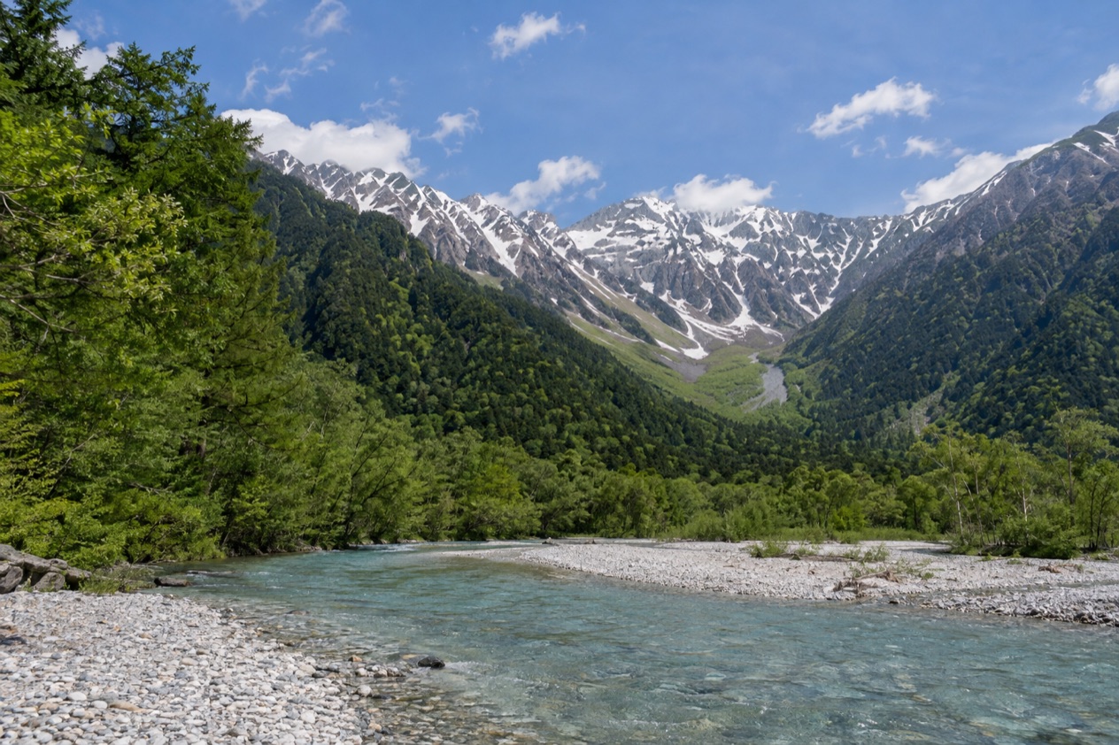
You step off the bus into a highland valley where the Azusa River runs clear beside the road, and the jagged line of the Hida Mountains stands at both ends of the view. Smoke rises faintly from Mount Yake, an active volcano, and the river bends past stands of trees toward a lake whose origin is a single eruption. Kamikochi is a national park valley in Nagano Prefecture, and a visit here is spent on foot among rivers, ridges and woods.
Is visiting Kamikochi worth it?
Yes, for anyone who wants a day or more of mountain walking and river views in the Japan Alps rather than a list of sights to tick off. It suits hikers, photographers, and travelers who like to let a landscape set the pace of the day. If your idea of Japan is temples, neon and food markets, this is the counterweight to it.
What sets Kamikochi apart from other highland stops nearby is how it is run. Private cars are kept out beyond the Kama Tunnel, so the valley is reached by shuttle bus or taxi, and the road does not fill with traffic.
The valley sits within Chubu-Sangaku National Park and carries two honors, Special Natural Monument and Special Place of Scenic Beauty, part of Japan’s National Cultural Assets. That protection shapes the whole visit: you arrive by public transport, you walk, and you leave when the buses do.
It is also a place with a seasonal rhythm. The valley is officially open from mid-April to mid-November, so it is not a destination you can drop into on any weekend of the year. Plan around the calendar and the trip fits together naturally, from the first spring opening to the leaves of October.
What to see at Kamikochi
The valley is a long, narrow strip of land with the river as its spine, and most of what you see is a variation on three things: water, forest and mountain. Mount Hotaka closes the northern end, Mount Yake the southern end. Everything in between is walked, with the visitor center as the point where buses drop you and where the day begins.
The Azusa River
The Azusa River runs the full length of the valley, and it is the headwater of the Shinano River, the longest river in Japan. Knowing that changes how you look at it. The clear stream beside the path is the very start of a waterway that will cross much of the country before it reaches the sea.
Walking beside it is the core of a Kamikochi day. The river splits around gravel bars, slides under footbridges and reflects the ridgelines when the sky is open. Photographers set up along its banks, and walkers simply follow the water for as long as they like, then turn around and return the same way.
Lake Taisho and Mount Yake
Lake Taisho was formed by the eruption of Mount Yake in 1915, during the Taisho period. Mud and debris dammed the Azusa River, and the water rose to fill the lake at the base of the volcano. Because the lake is so young, it is often described through the tree trunks that stand in the water, the remnants of the forest that was flooded.
Mount Yake is still an active volcano, which gives the southern end of the valley a different character from the northern one. Look for the contrast between the still surface of the lake and the bare, rough slopes above it. It is a place to stand for a while and understand how recently the landscape was rearranged.
The Hotaka side of the valley
At the northern end, the valley is bordered by Mount Hotaka, part of the high ridgeline of the Northern Japan Alps. From the valley floor you see the mountains as a wall, with the forest rising up its lower slopes. The valley floor itself climbs gently from south to north, which is why the same river feels different at each end of the walk.
This is the side of Kamikochi that connects to the history of mountaineering in Japan. Each June the Weston Festival honors Rev. Walter Weston, whose work is remembered for the conservation of the Northern Japan Alps. If your visit falls in that month, the festival is a chance to see the valley as a place with its own traditions, not only a stretch of scenery.
Hours, tickets and rules
Kamikochi works by season rather than by daily opening hours. The valley is officially open from mid-April to mid-November, and outside those months the visit is not on. The details of how you get in matter more than a ticket window, because access is controlled at the Kama Tunnel.
| Site | Season |
|---|---|
| Kamikochi | Mid-April to mid-November |
Private vehicles have been restricted from entering beyond the Kama Tunnel since 1994, for traffic management and environmental reasons. Access is limited to shuttle buses, taxis, and forestry and maintenance workers’ vehicles. Drivers must park at the Hirayu or Sawando parking areas, from where shuttle buses or taxis carry visitors to the park visitor center.
How to get to Kamikochi
Kamikochi is reached by bus or taxi from a parking area, never by driving your own car into the valley. Most travelers come through Matsumoto, a city in Nagano Prefecture at the eastern end of the Japan Alps, and then continue by public transport into the mountains.
From Matsumoto
From Matsumoto, an integrated park transportation ticket is available. It combines the Highland Rail service of the Kamikochi Line to Shin-Shimashima, the rail terminal, with the Highland Bus service provided by Alpico Kotsu. The whole journey takes about 1 hour and 50 minutes.
Matsumoto itself is a convenient base because it is reached by train from several cities. From Tokyo’s Shinjuku Station the train takes 2 hours and 40 minutes, from Nagoya Station 2 hours, and from Nagano Station 50 minutes. Matsumoto Airport has commercial flights only from Osaka, Sapporo and Fukuoka, with downtown about 20 minutes away.
Direct buses and driving
Longer distance and overnight buses run directly to Kamikochi from Tokyo (Shinjuku), Nagoya, Kyoto and Osaka. That gives travelers coming from those cities a way into the valley without changing in Matsumoto.
If you arrive by car, the Hirayu and Sawando parking areas are where the drive ends. From there, shuttle buses or taxis take you to the visitor center. Leaving the car and switching to a bus is simply part of the arrival, as it has been since 1994.
When to visit Kamikochi
Kamikochi can be visited from mid-April to mid-November, and the choice of month shapes what you see. Spring is the opening of the valley after its closed months. June brings the Weston Festival, honoring Rev. Walter Weston and his contribution to the conservation of the Northern Japan Alps.
Summer has the most visitors during school holidays, from the end of July through the end of August. The valley also draws peak crowds when the autumn leaves peak in October. If you want the valley with fewer people around, the other months of the open season are the ones to look at, with the schedule set by the park’s mid-April to mid-November window.
A trip timed for the October leaves puts the river, the lake and the forest together under changing color, and it is the reason many travelers plan their autumn in Nagano around Kamikochi. A trip in June is for those who like to be in the valley on a day when its history is celebrated. Each month offers its own version of the same landscape.
Tips for your visit
Think of Kamikochi as a day of walking beside the Azusa River with the mountains at either end. Start at the visitor center, where the buses from the parking areas arrive, and decide how far along the valley you want to go. The valley is long, so you do not have to see all of it to have a full visit.
Because the way in is by bus or taxi, plan your day around the return journey as well as the arrival. Staying a night in the area opens up more time along the river, while a single day trip from Matsumoto gives you the highlights of the valley. Matsumoto is also worth a stop on either side of the trip, as a city at the foot of the Japan Alps with its own streets and meals to enjoy.
Pair Kamikochi with a stay in Nagano Prefecture rather than rushing in from a far city. Travelers coming from Tokyo, Nagoya, Kyoto or Osaka can use the direct buses, while those who prefer trains can base themselves in Matsumoto. Whichever route you choose, leave room in the schedule for time by the river, since that is the point of the trip.
Good to know before you go
In Matsumoto, Japanese IC cards do not work on buses, but contactless payment with major credit cards, except Mastercard, is possible. That is useful to know before you board in the city that serves as a gateway to the valley. The valley itself is a protected national park, so the habits that suit it are the simple ones: stay on the paths, take what you carry back out, and let the season set your plans.
Sources
- Wikipedia, Kamikōchi (https://en.wikipedia.org/wiki/Kamik%C5%8Dchi), checked October 11, 2026
- Japan National Tourism Organization, Matsumoto (https://www.japan.travel/en/destinations/hokuriku-shinetsu/nagano/matsumoto-and-around/), checked October 11, 2026
- Wikipedia, Matsumoto, Nagano (https://en.wikipedia.org/wiki/Matsumoto,_Nagano), checked October 11, 2026
- Wikivoyage, Matsumoto (https://en.wikivoyage.org/wiki/Matsumoto), checked October 11, 2026
To plan your stay
- Best Time to Visit Japan: Cherry Blossoms, Autumn Colors, Weather and Festivals
- Where to Stay in Japan: Ryokan, Temple Stays, Capsule Hotels and the Best Cities to Base In
- Sending Luggage from the Airport in Japan: Hands-Free Travel, Hotel Delivery and Coin Lockers
- Know Before You Go to Japan: Entry, Money, Etiquette and Getting Around