
Out on St. George’s Caye the day starts with the sound of water against the dock and the sight of the mainland haze fading behind you, while pelicans settle on the pilings and a screen door bangs somewhere in the village. This is a small island with a very large past, once the biggest settlement in British Honduras and the first capital of the colony. It suits travelers who like their Caribbean with a story attached, a place to sit, look at the sea and think about how Belize began.
Where is St. George’s Caye and what is it like?
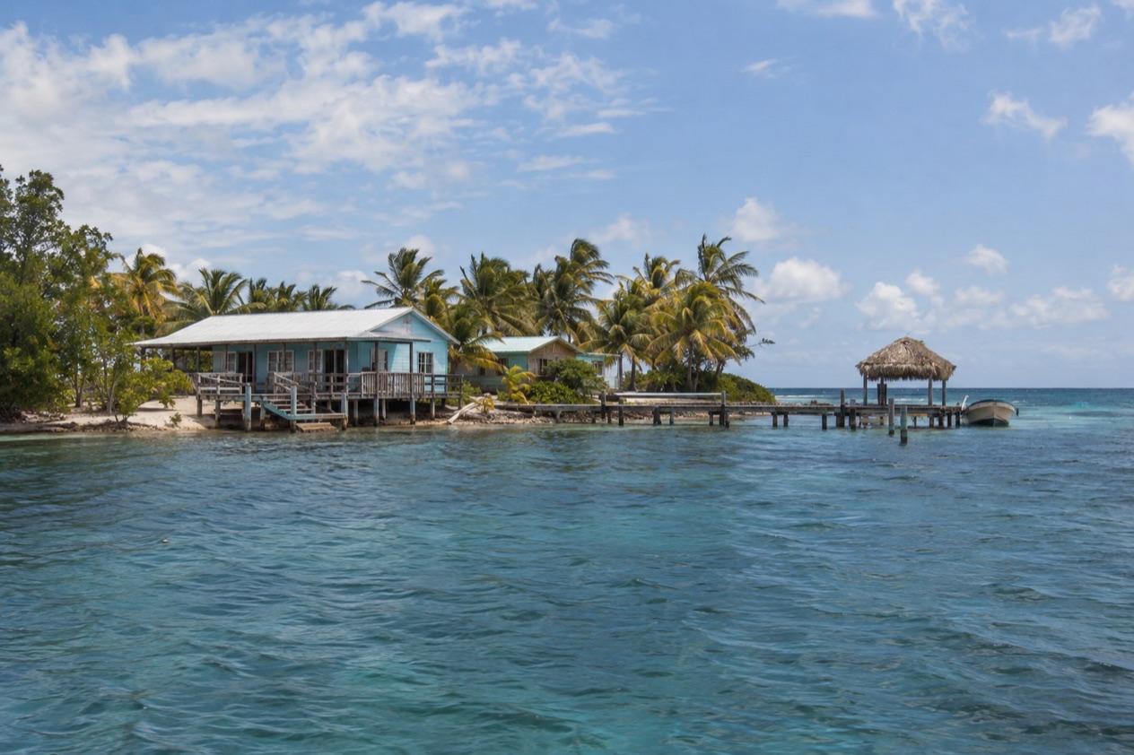
St. George’s Caye is an island in the Caribbean Sea, eight miles east of Belize City, in the Belize District. The village on the island carries the same name, so the caye and its community are one and the same, a compact settlement set on a low patch of sand and mangrove rather than a town with neighborhoods and highways.
Its character comes from the contrast between size and significance. The Spaniards once called it Cayo Cocina, the Kitchen Cay, and the English-speaking settlers who came after built a town here that was settled in 1650.
For a stretch of the 1700s this little island was where the business of the colony was done. You will not find traffic, a boardwalk of souvenir shops or a long strip of nightlife. You will find a quiet shoreline, a sense of being offshore and a place whose name shows up in Belizean schoolbooks.
Who loves it: people who prefer a low-key island to a lively one, history readers, and anyone who likes to be on the water and then back to a calm village. Who may not: travelers who want a long list of restaurants, bars and organized activities within a few steps of their door. The caye is a place to slow down, and its pleasures are the view, the light on the sea and the feeling of standing where the colony once had its seat.
Belize City, the largest country’s city by population and its principal port, is the mainland neighbor, sitting at the mouth of Haulover Creek on the Caribbean coast. Seen from the caye, it is the city on the horizon, the place that took over the commercial role the island once held. Together the two tell the arc of the country’s early story, from a settlement on a cay to a port city on the creek.
The sea defines everything here. Water surrounds the village on every side, and the rhythm of island days follows boats, tides and the sky. The same Caribbean that frames the caye washes the barrier reef offshore from Belize City, a reef that Hurricane Hattie heavily damaged along much of its length in the storm of 1961, a reminder of how exposed this coast can be.
What is there to do in St. George’s Caye?
The reasons to come are few and clear: the history, the setting on the water and the chance to see the coast from an island that has watched it change. What sets St. George’s Caye apart from its neighbors is that it is a village with a past as a capital, not a resort built around a single beach or a dive shop.
Walking through Belize’s early history
The caye was the largest settlement in what was then British Honduras during the 1600s and 1700s, and it served as the first capital of the colony in the 1700s. That makes the island itself the sight. You walk the village paths with that in mind, picturing a harbor busy with the trade of the timber settlers and a population that once outnumbered anything on the mainland coast.
This suits readers who like to understand a place before photographing it. Bring the story with you, and let the quiet of the island fill in the rest. The older names help, too. Cayo Cocina, the Kitchen Cay, is a good one to repeat when someone on the island asks what drew you out here.
Time on the water and the shoreline
Everything on the caye faces the Caribbean. The pleasure is simple: a dock at first light, a long look at the horizon, the color of the sea shifting through the day from pale green near the sand to deeper blue farther out. Pelicans, frigatebirds and terns work the shallows, and the mainland shows as a low line on the western side.
It is a place for sitting more than doing, which is its appeal. Pair a morning like that with an unhurried lunch and an afternoon of reading, and you have understood the island. Anyone expecting a program of scheduled outings should know that the caye is built around stillness.
The caye and the city together
Belize City is the natural counterpoint to the island, and its sights tell the other half of the story. The Swing Bridge across Haulover Creek is the only functioning, manually operated swing bridge in the world, and watching it turn is one of the small, specific pleasures of the city. The harbor area, where the Fort Street Tourism Village stands on the northern bank at the creek mouth, shows why the port took over from the caye.
Seeing both gives you the full picture: the first capital offshore, the later capital on the creek and, in the story of the storm that prompted the government to move inland to Belmopan, the reason neither is the seat of government today. Travelers who enjoy that kind of connected history will find that the island and the city explain each other.
How many days do you need in St. George’s Caye?
A long weekend is the right length for St. George’s Caye, since the island rewards a slow stay more than a packed schedule. One night is enough to feel the place in the evening and the early morning, which are the quietest hours, and two or three nights let the pace settle in.
In a short stay, the pattern is simple: arrive, walk the village, learn the story of the colony’s first capital, and spend the rest of the time looking at the sea. The caye’s size is part of the point, and there is no need to hunt for things to fill the hours. Take a book, a hat and a willingness to do very little, and the days feel full.
With more time, the natural addition is Belize City, the island’s mainland neighbor. Its Swing Bridge, its harbor and the Fort Street Tourism Village at the mouth of Haulover Creek give a day of city sightseeing against the caye’s calm. The city also lets you trace the thread of the story, from the settlement on the island to the port that grew on the creek.
Beyond that, the caye works as a pause between other parts of a Belize trip. It pairs with the cayes, rainforest and Maya sites elsewhere in the country, where the mood and the activities are quite different. Treat St. George’s Caye as the quiet chapter, a place that gives context to the rest of what you see, and plan it that way rather than trying to make it the whole trip.
Where to stay in St. George’s Caye
Sleeping on the caye puts you where the history happened and where the sea is at your door in every direction, with the early morning and the late evening to yourself once the day visitors have gone. It suits travelers who value atmosphere over amenities and who are happy with a small, quiet base.
The island is a single village, so there are no districts to choose among, and the decision is mostly about how close you want to be to the water and how much you want to be part of the village routine. Choose a spot that gives you a view of the sea, since that is the island’s main asset, and settle in for a stay measured in nights rather than weeks.
The alternative is Belize City on the mainland, eight miles away across the water. It is the country’s largest city, its principal port and its financial and industrial hub, and it suits travelers who want city sightseeing, the harbor and the Fort Street Tourism Village close at hand. The Swing Bridge and the creek-mouth waterfront are the draws, and a night or two there fits well before or after time on the island.
The choice comes down to mood. The caye offers stillness and a sense of history in a small place, and the city offers a working port and the bustle of a capital that once was. Many travelers want a taste of each, and since the two are neighbors across the water, combining them is natural, island first for calm or city first for context.
How do you get to St. George’s Caye and get around?
St. George’s Caye lies eight miles east of Belize City, so the way in runs through the city and then across the water to the island. Belize City is the country’s principal port, with its waterfront at the mouth of Haulover Creek on the Caribbean coast, and it is the mainland point of reference for anyone heading out to the caye.
The Belize Port Authority is the body that oversees the country’s ports, and it is the contact for questions about port matters in the city.
Once on the caye, getting around is a matter of walking. The island is a village of modest size set on a low cay, and its paths and shoreline are the whole network. There are no highways or bus routes to learn, and the scale of the place is part of the charm. You move at the speed of a stroll, and the sea is never far from view.
In Belize City, the core of the waterfront around the Swing Bridge and the creek is where visitors tend to orient themselves. The city is the largest in the country, with a population of 63,999 in the 2022 census, so it has a more urban feel than the island it faces. Plan the crossing and the city stay as parts of one journey, and treat the caye as the quiet end of it.
When is the best time to visit St. George’s Caye?
The cooler winter and early spring months, from December through May, make the most comfortable window, and they also fall outside the official Atlantic hurricane season, which runs from June 1 to November 30. January gives a sense of the mood. In Belize City, highs average 83.2°F and lows 68.0°F, warm enough for the water and the shade but without the heaviness of summer.
The hotter months are the other end of the calendar. July is a good example. In Belize City, highs average 89.3°F and lows 77.0°F, which makes for warm nights and a sea-level warmth that never really lets up. It is also inside the hurricane season, which runs through November, so the late summer and autumn months belong to the part of the year when a tropical system can affect plans.
Rain shows up in every month, so no season is rain-free. In Belize City, January records 4.97 inches over 10.3 rainy days and July 5.73 inches over 11.8 days. The difference between the two is modest, which means packing a light rain layer makes sense whenever you go. The real contrast between seasons is in warmth and in the hurricane calendar, not in a switch from wet to dry.
The island’s history is the reason to time a visit with care if you can. The place is quietest when little is going on, and the winter and spring months suit its pace. Pick those months if you want the island at an easy temperature, and remember that the hurricane season is a real part of life on this coast, as the storm of 1961 showed in Belize City.
Good to know before you go
The U.S. State Department rates Belize Level 2, “Exercise increased caution”, because of crime, and says the south side of Belize City has historically had the highest concentration of violent crime.
The hurricane season runs from June 1 to November 30, and the coast around Belize City has a long memory of what a major storm can do. Hurricane Hattie reached Category 5 in 1961 and damaged over 70% of the buildings in the city, which led the government to move the capital inland to Belmopan. Keep the season in mind when you plan, and follow the guidance of local authorities if a system approaches.
The island is a small village, so pack for a quiet stay and bring what you need for the sea, the sun and the rain, since the caye is not a place of large shops. Belize City, by contrast, is a working port and the country’s biggest city, and a little ordinary city awareness goes a long way there.
Sources
- Wikipedia, St. George's Caye (https://en.wikipedia.org/wiki/St._George's_Caye), checked October 11, 2026
- Wikipedia, Belize City (https://en.wikipedia.org/wiki/Belize_City), checked October 11, 2026
- Wikipedia, Hurricane Hattie (https://en.wikipedia.org/wiki/Hurricane_Hattie), checked October 11, 2026
- Belize Port Authority, Fort Street Tourism Village port (https://portauthority.bz/belize-port-facilities/fort-street-tourism-village-port/), checked October 11, 2026
- Wikipedia, Climate of Belize (https://en.wikipedia.org/wiki/Climate_of_Belize), checked October 11, 2026
- NOAA NCEI, GHCN-Daily station BHM00078583 (Philip S. W. Goldson International Airport, Belize City), normals 1991-2020 computed from the daily record (https://www.ncei.noaa.gov/access/services/data/v1?dataset=daily-summaries&stations=BHM00078583), checked October 11, 2026
- U.S. Department of State, Belize Travel Advisory, Level 2, March 11, 2026 (https://travel.state.gov/), checked October 11, 2026
- NOAA National Hurricane Center, Climatology (https://www.nhc.noaa.gov/climo/), checked October 11, 2026