
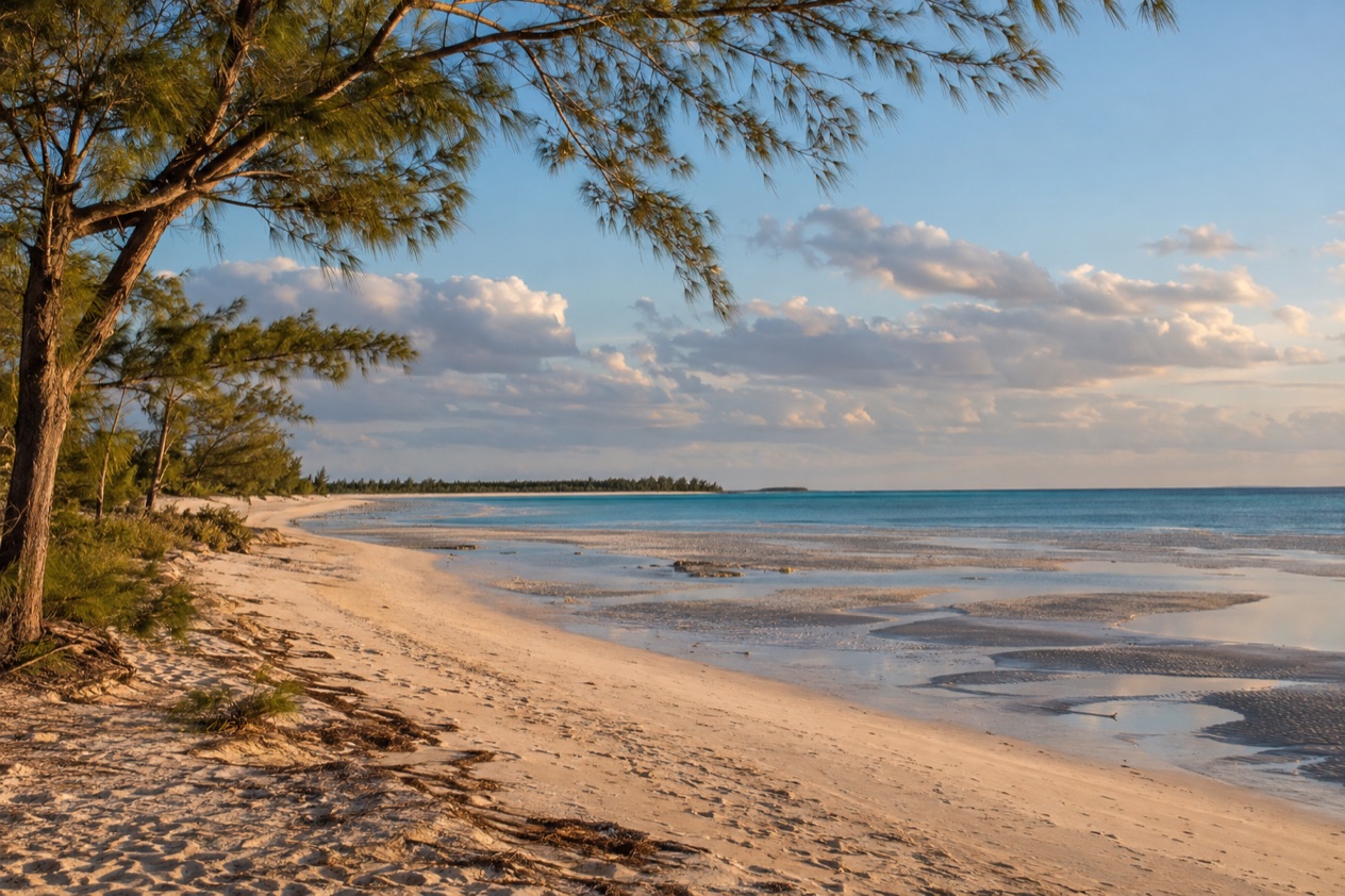
You come out of the pines and casuarinas on Grand Bahama and the trees open onto a wide, pale beach with almost nothing built on it. There is the sound of small waves, the rustle of needles overhead, and a shoreline that seems to keep going. Gold Rock Beach is a simple, unhurried stop on the island’s quieter side, a place for walking, a picnic and an afternoon beside the Lucayan National Park.
Is visiting Gold Rock Beach worth it?
Yes, if you like beaches that ask little of you: it suits travelers who would rather walk a long shoreline and eat a picnic under the trees than lie in front of a bar with a menu. It is described as secluded and spectacular, and the description fits the mood. There is no resort behind the sand, no row of chairs, and no sound system.
What sets it apart from the beaches near Freeport is how little is there. The beach sits inside The Lucayan National Park and is protected by the Bahamas National Trust, so the setting stays green and unpolished. The amenities are barbecue pits, picnic tables and benches, and nothing more.
At low tide the shoreline spreads for yards into the sea, which is why it is called Grand Bahama Island’s welcome mat. It is about 25 miles from Freeport, so it is a real outing, and it pairs naturally with the caves just across the road.
It will not suit someone who wants a beach club, a cold drink on tap or a day of organized activity. It does suit couples, families who bring their own lunch, photographers who like wide empty horizons, and anyone who has already seen the busier shorelines and wants a contrast. Bring what you need, because the beach itself offers shade, seating and grills, and not much else.
What to see at Gold Rock Beach
The beach and the low-tide flats
The main attraction is the shoreline itself. When the tide goes out, the beach seems to double in width, and the wet sand spreads far into the sea in a broad, shining apron. The nickname of welcome mat makes sense once you see it, a pale carpet laid out toward the water.
Look for the patterns the water leaves behind: ripples in the sand, tiny channels, shells and bits of coral rubble, and the different colors where the shallows meet deeper water. It is a good place for a slow walk and for photographs when the light is low. The sand takes on a warm tint in the late afternoon, which fits the name.
The picnic area under the trees
Behind the sand, the beach is set up for people who bring food. There are barbecue pits, picnic tables and benches, and that is the full list of amenities. This is the part of the visit that feels most local, a spot for grilling, lingering and watching the tide change.
The benches also work as lookouts when you only want to sit and watch the water. Everything you need for a meal has to come with you, so treat the tables as a place to unpack, not as a stop on the way to a restaurant.
The Lucayan caves across the street
North of the beach, across the street, are the Lucayan Caverns, described as the world’s longest surveyed underground cave system. The wider park contains an underwater network with 6.4 miles of charted tunnels. Two caves are open to the public, and you look into them from above, since swimming in the caves is prohibited.
Diving here needs a special permit, so this is a place to look and wonder, not to jump in. The caves are one of the park’s best-known features, and the contrast with the open beach is sharp: bright sand and wide sky on one side of the road, cool dark limestone on the other.
Trails, boardwalks and birds
The park’s nature trails and boardwalks lead to a variety of ecosystems, so the visit can turn from beach to woodland, wetland and coast in a short stretch of the island. The park is an Important Bird Area, with habitat for the thick-billed vireo, the Bahama swallow and the olive-capped warbler. Birds are chances, never promises, so go slowly and listen.
The area also has a place in science: the Remipedia class of crustaceans was discovered here in 1979, before the park existed. You will not see them, since they live in the water-filled caves, but the story adds depth to the walk. The park is called the star of the island’s three parks.
Hours, tickets and rules
The beach is part of a protected national park, and the rules are about caring for the caves and the setting. The park itself covers 40 acres of land on Grand Bahama and was established in March 1982. The table gathers what you can and cannot do on site.
| Place | What is there | Rule |
|---|---|---|
| Gold Rock Beach | Barbecue pits, picnic tables and benches | No other amenities |
| Lucayan caves | Two caves open to the public | Swimming in the caves is prohibited |
| Lucayan National Park diving | Underwater cave system | A special permit is required for diving |
| Lucayan National Park trails | Nature trails and boardwalks | Lead to a variety of ecosystems |
For questions about the park, the contact given is Mrs. Cecilia Bodie at the local number (242) 352-5438. The park is protected by the Bahamas National Trust, and swimming in the caves and diving without a permit are the two limits to know before you arrive. Apart from these, expect the setting to be left as natural as possible, so carry out what you carry in.
How to get to Gold Rock Beach
Gold Rock Beach is on Grand Bahama Island, about 25 miles from Freeport, and it lies inside The Lucayan National Park. The park is near Freeport, the island’s main town, which is the natural base for the trip. No time range for the journey is given, so think of it as a day outing from town, not a quick stop.
Once you are there, the geography is simple. The beach lies on one side of the road, and the Lucayan Caverns are north of it, across the street. That makes the two easy to combine in the same visit, and you do not need a second trip to see both.
Grand Bahama is a separate island from Nassau and New Providence, reached on its own. If you are staying in or near Freeport, plan the outing around the beach and park together, and carry your food, water and anything else you need, since nothing is sold at the beach itself.
The route runs through a landscape of pine and low scrub, typical of the island away from town. It is a pleasant change of scene from the resort strip, and it prepares you for the natural mood of the beach. Plan to arrive with time to spare so that the beach, the picnic and the park fit comfortably into one day.
When to visit Gold Rock Beach
The best time of day is when the tide is low, because the shoreline spreads far into the sea and the beach looks its widest. Tide times change daily, so the hour that suits you one day will not suit you the next. Go with a flexible afternoon and let the water set the schedule.
Early and late in the day, the light is softer and the sand glows with a golden tint, which is good for photographs and for a long walk without the strongest sun. Midday sun on an open beach is hot, and the trees behind the sand give the only natural shade, so plan the picnic accordingly.
For the season, the Atlantic hurricane season runs from June 1 to November 30, and the months from December to May fall outside it. Storms can still bring rough seas, wind and rain earlier or later in the year, and a day of wet weather is a day to spend in the park’s woods and on its boardwalks, not on the beach.
There is no festival or special date tied to the beach itself. The draw is the tide, the light and the quiet, and a visit can be rewarding in any month as long as the weather cooperates. The season of birds in the park can change what you see on the trails, though no particular month is promised.
Tips for your visit
Bring everything you need. The beach has barbecue pits, picnic tables and benches and no other amenities, so pack food, drinking water, sun protection and a bag for your trash. A hat and a light cover-up help on the open sand, and shoes you can walk in suit the park’s trails.
Plan to spend a good part of the day. The beach alone invites a slow walk and a meal, and the caves across the street add a second stop with a very different feel. Do them in either order, but give the beach the time the tide allows, since the wide low-tide flats are the main attraction.
Combine the beach with the park. The trails and boardwalks lead through different ecosystems, and the caves are a short step across the street. Remember that swimming in the caves is prohibited and that diving needs a special permit, so the caves are for looking only.
For families, the picnic tables and the open sand make an easy setting for a meal and a stroll, and children often enjoy poking around the shallows at low tide and looking for shells. For anyone with limited mobility, no facts are given about paths or access, so decide with that in mind and plan for a simple visit at the picnic area.
Bring a camera for the birds and the shoreline. The park is an Important Bird Area, and the beach at low tide makes a wide, bare foreground for pictures. Take your time, keep your voice low on the trails, and leave the place as you found it.
Good to know before you go
The U.S. State Department rates the Bahamas Level 2, “Exercise increased caution”, and says most crime occurs in Nassau on New Providence and in Freeport on Grand Bahama.
Gold Rock Beach has no shops or services of its own, so bring what you need and plan the day before you set out from Freeport. The Atlantic hurricane season ends on November 30, so a trip in the final weeks of the year can still meet unsettled weather. Treat the beach and the caves as part of a protected park, keep to the rules, and leave only footprints in the sand.
Sources
- Bahamas Ministry of Tourism, Investments & Aviation (bahamas.com), Gold Rock Beach (https://www.bahamas.com/natural-wonders/gold-rock-beach), checked October 10, 2026
- Bahamas Ministry of Tourism, Investments & Aviation (bahamas.com), Lucayan National Park (https://www.bahamas.com/natural-wonders/lucayan-national-park), checked October 10, 2026
- Wikipedia, Lucayan National Park (https://en.wikipedia.org/wiki/Lucayan_National_Park), checked October 10, 2026
- U.S. Department of State, The Bahamas Travel Advisory, Level 2 (https://travel.state.gov/), checked October 10, 2026
- NOAA National Hurricane Center, Climatology (https://www.nhc.noaa.gov/climo/), checked October 10, 2026
To plan your stay
- Best Time to Visit the Bahamas: Weather, Hurricane Season, Sea Temperatures and Junkanoo
- Where to Stay in the Bahamas: Best Islands, Resorts, Boutique Stays and How to Choose
- Getting Around the Bahamas: Flights, Ferries, Mailboats and Taxis in Nassau
- Know Before You Go to the Bahamas: Entry Rules, Money, Getting Around and Local Customs