
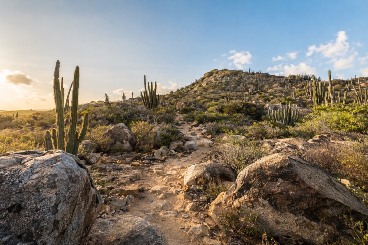
Early on an Aruban trail, the first sound is wind combing through the cactus ridges, and the first sight is a pale dirt path running toward a cliff edge and a very blue sea. Goats scatter ahead of you, a parakeet flashes green across the scrub, and the sun is already warming the stone. Hiking in Aruba happens in the dry, rocky interior and along the wild coast of Arikok National Park, and it suits anyone who likes to earn a view.
Where can you hike in Aruba?
You hike mainly in Parke Nacional Arikok, which covers a large part of the island’s rugged side, and on Hooiberg, the conical hill rising from the flat middle of the island. Between them they give you two very different outings: a day among lava, limestone and hidden bays, and a climb with a single clear goal at the top.
The trails are not manicured promenades. They wind alongside cliffs, blue seas, natural pools and cacti, and the reward is the kind visitors rarely find at the resort beaches: stunning views, solitude and a little adrenaline. Aruba’s reputation is all beach chairs and cocktails, yet a morning on foot in the interior shows you an island of stone and thorn, and many travelers say it is the part they remember longest.
Dirt paths and prickly-pear plains
The variety underfoot is part of the pleasure. Some trails are plain dirt paths, others are hidden paths that seem to appear only when you are already on them, and some cross open plains littered with prickly pear. The ground can be loose and stony, so you watch your footing more than you would on a boardwalk, and you look up often because the scenery keeps changing.
The vegetation is low, spiny and silvery green, shaped by wind and little water. Columnar cacti stand like fence posts along ridges, and the light on the rock turns gold early in the day. You will not find tall trees to rest under, which is why the pace and the hour you choose matter so much.
Cliffs, bays and natural pools
The coast is where the hiking turns dramatic. The park holds secluded bays such as Moro, Boca Prins and Dos Playa, along with caves, Indian rock drawings, lava formations, quartz diorite and limestone. A single walk can pass from black volcanic rock to pale limestone terraces within a short stretch of land, and you see how the island was built layer by layer.
One destination draws many hikers: the Conchi Natural Pool, also called Aruba’s natural pool. It is made of ancient lava stone and sits among some of the most rugged terrain on the island, which is what makes reaching it feel like an accomplishment. The trail from the park’s visitor center to the pool is an out-and-back route, so you retrace your steps and see the same landscape from the other direction on the way home.
What are the guided hikes in Arikok?
The guided hikes in Arikok are three named outings, Rooi Tambu & Dos Playa, Jamanota Hill and Miralamar, plus a private guided option for visitors who want a slower, more personal pace. Organized tours led by park rangers are highly recommended, because they explain the flora, fauna and viewpoints you would otherwise walk past.
Everything starts from the San Fuego Visitor Center inside the park. A ticket is required to enter Arikok, and the small entrance fee supports preservation, educational programs and the animals that live there. The park is a great place to spend an entire day, so a guided hike can be the heart of a longer visit that also takes in caves and bays.
| Site | Open |
|---|---|
| San Fuego Visitor Center, Parke Nacional Arikok | Daily, 8:00am to 3:30pm |
| Guided hike | Guided hike fee | Group size |
|---|---|---|
| Rooi Tambu & Dos Playa | $25 | Maximum 10 people |
| Jamanota Hill | $25 | Maximum 10 people |
| Miralamar | $25 | Maximum 10 people |
Rooi Tambu & Dos Playa
This is the longest of the three, covering 4.6 miles through the park’s wilder terrain toward the Dos Playa bay. You move from inland scrub to the edge of the sea, and the landscape opens up as you approach the coast, with rock walls, wind and the sound of surf carrying uphill to meet you.
It suits walkers who enjoy a full outing and do not mind heat, since the route asks for endurance. Bring plenty of water and sunscreen, wear shoes with grip for the stony ground, and expect a group small enough that you can talk with the guide and ask about the plants and rocks you pass.
Jamanota Hill
Jamanota is the highest point on Aruba, standing at 617 feet, which makes this hike the one for views. The guided route covers 2.9 miles, climbing through cactus country toward a summit that looks over the interior and out toward the sea.
It is a good pick if you want to see the island’s high ground with someone who knows it. Hooiberg gets more attention because of its staircase, yet Jamanota holds the title of tallest formation, and standing on it adds a pleasing sense of having seen the island from its true top.
Miralamar and the private guided hike
Miralamar is the third guided outing on the program and carries the same fee and group limit as the others. The name, which suggests a view of the sea, fits the way many hikes here end: with a long look at water and sky after a stretch of dry, spiny country.
If a group does not appeal, a private guided hike lets you explore birds, flowers and geology at your own pace. This option favors curious travelers, bird-watchers and anyone who likes to stop often, lean in over a flower or a rock face, and ask questions without the rhythm of a bigger party.
Can you climb Hooiberg?
Yes, Hooiberg has a concrete staircase of roughly 600 steps that hikers take to the top. The hill stands in the center of the island, and its name is the direct Dutch translation of haystack, which is exactly what its rounded cone looks like from a distance.
It rises 540 feet above the island, and because the surrounding land is so flat, it is visible from almost anywhere. Its rock is hooibergite, a hornblende-rich mela-diorite, a name that exists only for this hill and sounds like a local secret.
The staircase and the climb
The staircase was built in 1951 so that crews could maintain the radio and television masts and a navigation light on the hill. Today it serves hikers, and you climb step after step with the island spreading out behind you. There is little shade, so the effort is more about heat and rhythm than about steepness.
On the way up, you may meet wild goats, parakeets and colorful lizards, which often appear on the stones beside the steps. Stopping to watch them gives you a natural reason to catch your breath. Families, casual walkers and fitness-minded travelers all share the staircase, each at their own speed.
The view from the top
From the summit, you get panoramic views over the whole island. The flat, dry landscape that looks plain from the ground becomes a map of pale roads, scrub, rooftops and the sea in the distance, and the wind is strongest up here. It is a lovely way to understand how small and open Aruba really is.
Many hikers pair Hooiberg with a day built around the coast or the park, since it sits in the middle of the island. A cooler part of the morning gives the best light and the most comfortable climb, and the descent goes quickly, leaving time for the rest of the day.
What should you know about heat and wind?
Heat is the main challenge on Aruban trails, and the wind is the constant companion that makes the heat feel gentler without making it go away. Hiking here can get hot and requires endurance, so you plan the outing around the sun rather than hoping for shade.
The wind blows from the east all year. It averages 16 mph in January at the airport, and it is felt most strongly on exposed ridges, summits and the rough windward coast. On a ridge it cools your skin and tugs at your hat, so a hat with a strap is a smart companion, and it can mislead you into thinking the sun is less strong than it is.
Water, sun and pace
Pack plenty of water and SPF, and carry more than you think you need. The landscape is open and dry, with little cover along most routes, so you rely on what is in your bag. Sunscreen should go on before you start, not once you feel the heat.
Pace yourself and take breaks where the view invites you to. A slow walk with frequent pauses is more enjoyable than a fast one, and it leaves you energy for the return. Start at the cooler part of the day, wear a hat and sturdy shoes, and let the wind do its work while you enjoy the scenery.
What the wind does to a hike
On a windy day the sound changes everything. Grass and cactus hiss, loose items flap, and on cliff-edge trails you feel the gusts pressing from the sea. Keep a firm grip on maps, hats and phones, and let the guide set the stopping points where the wind lets you stand comfortably.
The wind also shapes what you see, from the leaning, low-growing trees to the sculpted rock. It is the reason the landscape looks as it does, and understanding that makes each viewpoint more meaningful as you walk through it.
Good to know before you go
The U.S. State Department rates Aruba Level 1, ‘Exercise normal precautions,’ and says Aruba is generally a safe destination for travelers, with petty crime the main concern in popular tourist areas.
Bring water, sunscreen and sturdy shoes, and treat each hike as a morning commitment rather than a quick stop. Keep valuables out of sight when you park at trailheads, since petty crime is the main concern in popular tourist areas. A guided hike or a day inside Arikok pairs well with a quiet afternoon back at your hotel, with the wind at your back and a cold drink in hand.
Sources
- Aruba Tourism Authority, Hiking in Aruba (https://www.aruba.com/us/things-to-do/sports-and-golf/hiking-in-aruba-explore-the-best-hiking-trails), checked October 9, 2026
- Aruba Conservation Foundation (ACF), experiences (https://acf.aw/experiences), checked October 9, 2026
- Aruba Tourism Authority, Hiking trail Arikok visitor center to Dos Playa (https://www.aruba.com/us/explore/hiking-trail—arikok-visitor-center-to-dos-playa), checked October 9, 2026
- Aruba Tourism Authority, Arikok National Park (https://www.aruba.com/us/explore/arikok-national-park), checked October 9, 2026
- Aruba Tourism Authority, Hooiberg (https://www.aruba.com/us/explore/hooiberg), checked October 9, 2026
- Wikipedia, Hooiberg (https://en.wikipedia.org/wiki/Hooiberg), checked October 9, 2026
- Aruba Tourism Authority, The Lost Cave (https://www.aruba.com/us/explore/the-lost-cave-aruba), checked October 9, 2026
- Meteorological Department Aruba (meteo.aw), Summary Climatological Normals 1991-2020, Queen Beatrix Airport station (http://www.meteo.aw/files/Download/climatnormals19912020.pdf), checked October 9, 2026
- U.S. Department of State, Aruba Travel Advisory, Level 1, issued August 19, 2026 (https://travel.state.gov/content/tsg_aem/us/en/home/international-travel/travel-advisories/destination.abw.html), checked October 9, 2026
To plan your stay
- Best Time to Visit Aruba: Weather by Month, Peak Season and Festivals
- Where to Stay in Aruba: Palm Beach, Eagle Beach, Oranjestad and All-Inclusives
- Aruba Airport (AUA): Arrival, Getting to Your Hotel, U.S. Preclearance and Departure
- Know Before You Go to Aruba: Entry Forms, Money, Water and Local Customs