
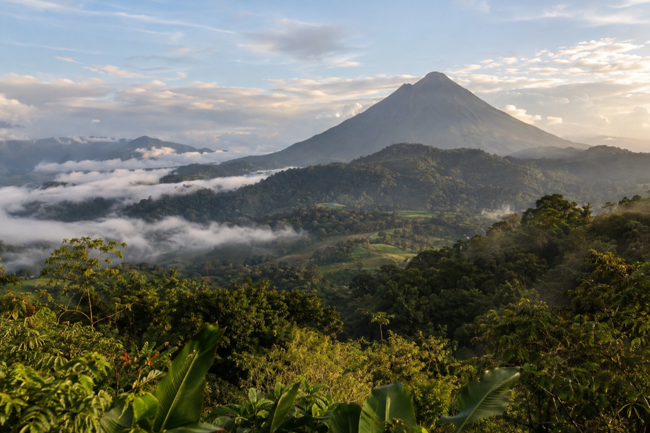
Halfway through the trip, you wake in a cabin in Monteverde with the windows fogged white, and the first sound is a hummingbird working the feeders on the porch. By afternoon you are lower down, in the heat, watching a sloth hang motionless over a trail near the Pacific. The route links a classic cone volcano, a misty mountain forest and a coast of monkeys and white-sand coves, with a surf town as a soft landing at the end.
Is 10 Days enough for Costa Rica?
Yes, for a first visit, as long as you accept that you are sampling the country and not finishing it. This route suits travelers who want one volcano, one cloud forest and one stretch of Pacific coast, and who are content to sleep in four or five places rather than eight. It is built around the roads that most visitors use, so the days feel full without feeling like a race.
The loop starts in the Central Valley, climbs north to the Arenal area, crosses the mountains to the cloud forest, and then drops to the central Pacific coast. Along the way you get hot springs, hanging bridges, a night walk among frogs and insects, and park trails where monkeys and sloths are commonly seen. That is a very good sample of what the country is known for, and it keeps the time in the car manageable.
What it leaves out is the long list of places that deserve their own trip. The Caribbean side, with Afro-Caribbean Puerto Viejo, the reef-fringed trail at Cahuita and the canals of Tortuguero, runs on a different weather pattern and needs its own days.
Tortuguero has no roads at all and is reached only by boat or small plane, so it does not fit a Pacific loop. Corcovado on the Osa Peninsula is remote, reached from Drake Bay or Puerto Jimenez. A night in a mountain hut comes with the multi-day trek up Cerro Chirripo. Each of those is a trip in itself.
If you are the sort of traveler who prefers to unpack once and stay put, trim the loop. Drop Monteverde and give the extra nights to the beach, or skip the mountains and base yourself on the Guanacaste coast. The full route runs from the cloud forest to the central Pacific coast, and the trip can be shortened by cutting Monteverde.
The itinerary stage by stage
The stages run in order from the first night to the last. Plan on one night in the capital, two in the Arenal area, two in the cloud forest, two on the central Pacific coast, and the remaining nights at a beach finish.
First night: San Jose and the Central Valley
Most visitors land at the airport beside San Jose and move on within a day, and that is a sensible plan. Set in the Central Valley at roughly 3,800 feet, the capital enjoys spring-like, gentle air, so the coastal blast of heat that catches travelers off guard is not what greets you. Should your plane touch down ahead of schedule, downtown offers the National Theater, which debuted in 1897 and ranks among the city’s most famous landmarks, along with the Pre-Columbian Gold Museum beneath the Plaza de la Cultura.
If you want background for the days ahead, the gold museum makes the stronger stop, because it displays what the peoples who were here before the Spanish created. Sleep near the center or close to the airport, whichever suits your arrival time.
When you have a spare morning prior to traveling north, the capital lies only a couple of hours from Poas Volcano, which is famous for an active crater of considerable size holding a turquoise acid lake. Morning tends to bring the clearest views from the top before the clouds arrive, so plan to head up early or skip it entirely.
Next two nights: La Fortuna and Arenal
In the northern lowlands, right at the base of Arenal Volcano, the small town of La Fortuna serves as the primary hub for a lake, hanging bridges, a waterfall and hot springs.
Spend the first morning in Arenal Volcano National Park, where short trails cross old lava and forest, and the cone and Lake Arenal come into view on clear mornings. By midday the peak is frequently lost in clouds, which is why an early visit to the park makes sense.
The afternoon is for the hot springs, which are best taken at dusk when the air cools and the steam rises. On the second day choose between the waterfall, the hanging bridges or a lake outing. Stay in town or in a lodge on the slopes, and expect the road toward the next stage to take its time.
Next two nights: Monteverde
High in the Tilaran mountains, near the town of Santa Elena, Monteverde is an area of cloud forest. You will find the air cooler here and frequently cloaked in mist, while ferns, orchids and mosses grow densely throughout the forest. Bring a warm layer, because after the heat of the lowlands the evenings feel properly cold.
On day one, set out on the paths of the Monteverde Cloud Forest Reserve, a misty mountain woodland it safeguards, full of epiphytes, hummingbirds and the resplendent quetzal. Travelers cross their fingers that a guide can help them spot the quetzal at dawn, though sightings are never guaranteed.
In the afternoon cross the hanging bridges through the canopy, or zip-line over the treetops if you want something louder. After dark, a guided night walk is the way to find frogs, insects and sleeping birds that you would never spot in daylight.
Next two nights: Manuel Antonio and Carara
From the mountains you drop to the central Pacific coast and the hills and beaches south of the town of Quepos. Manuel Antonio National Park is a small park of forest trails and white-sand coves, where monkeys and sloths are often seen close to the paths. Capuchins with white faces, squirrel monkeys, iguanas, and raccoons turn up often both inside and near the park, and guests are urged not to give them food.
Give the park a morning, walking slowly and stopping often, then spend the hot afternoon in a cove or by the hotel pool. The hillside hotels above the coast have views over the water and a steady chorus of birds at dawn.
On the way, or on the way out, Carara National Park near the Tarcoles River is a patch of transitional forest known for scarlet macaws, which are often seen flying at dawn and dusk. A stop there pairs well with a long drive day.
Final nights: a Pacific beach finish
Use the last days to stop moving. For a fun beach town with a long stretch of dark sand plus bars and restaurants, Jaco sits roughly two hours from San Jose by road and makes the simple pick. The waves there suit both new and seasoned surfers, and with instruction and boards available to rent, it is a tried-and-true place to catch your first ride. It also keeps the last drive to the airport short.
Should you prefer heading south, Uvita serves as the entry point to Marino Ballena National Park, where at low tide the beach creates a sandbar with the shape of a whale’s tail. Twice annually, humpback whales come to this coastline, roughly December through April and then roughly July through October, giving the world one of its longest stretches for watching whales.
Travelers heading to Guanacaste beaches such as Tamarindo or Samara may prefer to fly out of Liberia and should plan the route in that direction. Whichever you pick, leave the last morning free for a swim, a long breakfast and a slow drive to the airport.
Getting between stops
| Leg | How | Time |
|---|---|---|
| San Jose to Poas Volcano | Road | Within a couple of hours |
| San Jose to Jaco | Road | About two hours |
| Liberia airport to Tamarindo | Road | About an hour |
| San Jose to Santa Teresa | Road and car ferry from Puntarenas to Paquera, then a long drive on partly unpaved roads | Most of a day |
Costa Rica is small on the map and slow on the ground, so judge each leg by the road and not by the distance. The usual arrival point for most visitors is one of two international airports, Juan Santamaria, located by San Jose in the Central Valley, or Daniel Oduber Quiros, set at Liberia in the northwest, the one nearest the Guanacaste beaches. The choice between the two airports is worth considering when you book flights.
Driving is how most people link the stops, and the State Department notes several things worth knowing. When you reach an intersection, watch out, since plants or other objects may block your view, so stay alert while driving.
A four-wheel drive vehicle may be the only way to get to certain spots, particularly beaches and rural areas. When the rainy season hits, landslides can shut down certain roads, so it is best for travelers to avoid driving beyond urban areas after dark. Build the day around that last point and plan to arrive before dark.
Santa Teresa shows how a short distance can turn into a long day. Reaching it takes the better part of a day by car and boat, or a quick plane ride to a small landing strip close by, so a packed itinerary has no room for it.
You can get to Tortuguero just by boat or small plane, as there are no roads into the area. If you want either, treat it as a separate trip, or replace a stage of this route rather than adding to it.
What to book before your 10 Days in Costa Rica
Book the pieces that shape the route, and leave the rest loose. The first is the flights, because the choice of arrival and departure airport decides the whole direction of the loop. Lodging comes next, especially in small places such as Monteverde and around Manuel Antonio.
Guided experiences are the second layer. In Monteverde, visitors hope a guide will help them spot the quetzal early in the morning, and the cloud forest night walk likewise takes place with a guide.
If you ever add Tortuguero, night walks to see nesting turtles are done with a licensed guide, and the green sea turtles come ashore mainly from about July to October. In the green season especially, olive ridley turtles also arrive in big numbers at Ostional beach, which sits close to Nosara.
Each volcano has its own rules for getting in, and clouds often hide the summit by midday. Before you commit a morning to Arenal, Poas, Irazu or Rincon de la Vieja, look at the park’s official page for the current rules, because they change. Poas in particular is a morning visit. At its crater above Cartago, Irazu, which is the country’s tallest active volcano, is sometimes cold and windy.
What to leave free is just as useful. Keep the beach days open so that a rainy afternoon or a tired group does not break a plan. Leave the hot springs, the waterfall and the bridges flexible, so you can swap them with the weather. A multi-day objective such as Cerro Chirripo, with its night at a mountain hut, needs its own days, and it does not fit this route.
As far as paperwork goes, you need a passport valid for the whole trip, along with a return ticket or proof that you are traveling onward to another country and, if arriving from certain countries in South America or Africa, proof of yellow fever vaccination. Check the passport first, since immigration may deny entry if it is damaged.
Adapting the route
With less time, cut Monteverde and keep the rest. Go from San Jose to La Fortuna, then to the central Pacific coast, and spend the extra nights on the beach. A shorter version puts one volcano, one national park and one beach in a simple line, with fewer long drives and more time to sit still. When your trip runs longer, the simplest extras are another Pacific stopover on the Nicoya Peninsula, or a trip to Rio Celeste, where a path passes a waterfall on its way to the place two streams meet and make the river a milky turquoise.
The seasons change the feel more than the plan. In the Central Valley and along the Pacific side, a dry stretch runs from about December to April, while a green, rainy season, when rain usually shows up in the afternoon, lasts from about May to November.
In the green months, do the volcano and park mornings early and keep the afternoons for indoor stops, hot springs and the pool. Some roads may be blocked by landslides in the rainy season, so leave a little slack on driving days.
Year-round showers on the Caribbean coast keep their own beat, which means the green season brings no relief in that region. Whales, on the other hand, follow their own calendar.
From about December through April, and then again from about July through October, humpbacks come to the southern Pacific coast, which means either stretch of time works well for wrapping up in Uvita. Turtle nesting runs mainly from about July to October at Tortuguero and mostly in the green season at Ostional.
For families, favor the calm bays and short days. A calm, shallow stretch of water guarded by a reef and an island offshore defines the wide curved bay where Samara, a little beach town, sits, and its soft waves make it a favorite with families and beginning surfers.
Kayaking, horse riding and day trips to Playa Carrillo are easy extras. Beginners will feel at home in Tamarindo too, where surf schools offer board rentals and instruction, but you can find larger waves at beaches just a short drive to the north and south.
For a slower trip, stay longer in fewer places. Pair Arenal with the coast and skip the mountains, or pick one beach town and use it as a base for day trips.
Nosara, with its long Playa Guiones, steady surf and yoga studios, suits a pace built around mornings in the water and quiet afternoons. Experienced surfers who want a challenge can look at Puerto Viejo, where the Salsa Brava wave breaks over a shallow reef and is for experienced surfers only.
Good to know before you go
The U.S. State Department rates Costa Rica Level 2, ‘Exercise increased caution,’ due to crime; it says petty crime is common throughout Costa Rica and that violent crime also affects tourists, including armed robbery, homicide and sexual assault.
Costa Rica is a place to pack for two climates at once, with a light rain layer and a warm sweater for the mountains alongside the beach clothes. Keep valuables out of sight in parked cars and at the beach, since petty crime is common, and plan your driving so you reach each stop in daylight. A sunhat, sturdy walking shoes and a small daypack cover most of what the trails ask, and the pace everywhere is unhurried, so let the days stretch.
Sources
- U.S. Department of State, Costa Rica Travel Information, Traveling and transportation (https://travel.state.gov/content/travel/en/international-travel/International-Travel-Country-Information-Pages/CostaRica.html), checked October 8, 2026
- U.S. Department of State, Costa Rica Travel Information, Entry and exit requirements (https://travel.state.gov/content/travel/en/international-travel/International-Travel-Country-Information-Pages/CostaRica.html), checked October 8, 2026
- U.S. Department of State, Costa Rica Travel Advisory, issued April 1, 2026 (https://travel.state.gov/content/travel/en/traveladvisories/traveladvisories/costa-rica-travel-advisory.html), read via the State Department open data API on October 8, 2026
To plan your stay
- Best Time to Visit Costa Rica: Dry and Green Seasons, Weather by Region and Festivals
- Where to Stay in Costa Rica: Beach Towns, Cloud Forest, Volcano Views and Which Base Fits Your Trip
- Costa Rica Airports: San Jose or Liberia? Beaches, Drive Times and Getting to Your Hotel
- Know Before You Go to Costa Rica: Entry Rules, Money, Getting Around and Local Customs