
Halfway through the trip, you are standing on a wooden bridge in the cloud forest at Monteverde, with mist drifting between the ferns and a hummingbird hovering at an orchid. The days before it were hot springs and a volcano cone near La Fortuna, and the days after it are monkeys, white-sand coves and a whale-tail sandbar on the Pacific. This is a loop that starts and ends in San Jose and links the mountains, the lowland forest and the beach, for travelers who want to see the country’s different faces rather than sit in one place.
Is 2 Weeks enough for Costa Rica?
Two weeks is enough to see the best-loved side of Costa Rica, and it suits first-time visitors who want volcanoes, forest and beaches without spending half the vacation in a car. The country is small on the map, but the roads are slow, steep in places and sometimes unpaved, so each move between regions takes a good part of a day. A route built around four bases, with a few nights in each, leaves time to actually look at things.
This itinerary covers the northern lowlands around La Fortuna, the cloud forest of Monteverde, the central Pacific coast at Manuel Antonio, and the southern Pacific around Uvita. It gives you a volcano, a canopy walk, a national park full of monkeys and sloths, and a beach where humpback whales pass through in two seasons of the year. It is a loop, so you land and leave from the same airport near San Jose.
What it leaves for another trip is just as interesting. The Caribbean coast, with the Afro-Caribbean culture and reggae of Puerto Viejo, and the canals of Tortuguero, where green sea turtles nest mostly from about July to October, sit on the opposite side of the mountain spine and have their own weather and rhythm. That also holds for Nicoya Peninsula surf spots like Santa Teresa, Nosara and Samara, Guanacaste’s dry forests, and Corcovado National Park on the Osa Peninsula, a remote place you get to from Drake Bay or Puerto Jimenez.
If you fly into Liberia instead, you can flip the route and begin on the Guanacaste beaches, but the loop below is written from San Jose. Here, spots only sixty minutes apart may see completely different skies, so bring clothes for fog and sunshine together in one bag, and greet each vista as a possibility, not a guarantee.
The itinerary stage by stage
Days one and two: San Jose and the Central Valley
The majority of visitors arrive at the airport beside San Jose, a capital set up high in the Central Valley, where the climate stays gentle and much like spring. Use the first afternoon gently. The National Theater, one of the city’s best-known buildings, makes a pleasant stop for coffee and a look at its ornate interior, and below the Plaza de la Cultura, the Pre-Columbian Gold Museum shows gold pieces crafted by the people who inhabited this land before the Spanish came.
On the second day, head up toward Poas Volcano, a short drive from the capital. A turquoise acid lake sits inside its big active crater, and since clouds tend to move in later, the top is usually clearest early on, so get going at dawn. Sleep in San Jose again or in a small lodge in the hills, and keep the evening free. The next leg is the first long drive.
Days three to five: La Fortuna and Arenal
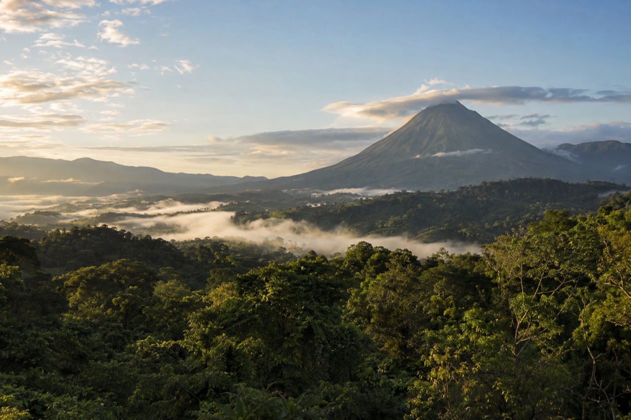
At the base of Arenal Volcano sits the little town of La Fortuna, which serves as the starting point for the hot springs, a waterfall, hanging bridges, and the lake. This classic cone saw nearly nonstop eruptions starting in 1968 and has stayed silent since 2010, which is why visitors arrive for the scenery and for treks across ancient lava flows, not to witness an eruption. Within the national park, brief paths lead you through the woods and over solidified lava, offering sights of the cone and Lake Arenal when morning skies are clear.
Set the volcano hike for the morning hours, when the peak has the best chance of appearing, then save the afternoon for a dip in the hot springs or a stroll across the hanging bridges. Clouds often hide the top by midday, so a gray afternoon is no reason to cancel the day. Stay in town or in one of the lodges on the road toward the park, and eat at the small family restaurants serving casado, the plate of rice, beans, salad and a main dish that is the everyday lunch of the country.
Days six to eight: Monteverde
The move to Monteverde goes around the lake by road, or by boat and van across Lake Arenal, and both take about the same time. The last stretch climbs a steep, partly unpaved road into the Tilarán mountains, where the air turns cooler and often misty. Santa Elena, the main village, has the guesthouses, cafes and tour offices, and most travelers sleep there or in a lodge in the forest above it.
A guided early-morning outing is how visitors hope to spot the resplendent quetzal, one of the treasures of the misty forest safeguarded by the Monteverde Cloud Forest Reserve, which also teems with epiphytes and hummingbirds. Past the reserve, there are hanging bridges to cross through the canopy, treetops to zip-line over, and a guided night walk to join in search of frogs, insects and sleeping birds. Bring a rain jacket and a warm layer, because the forest is damp even on a bright day.
Days nine to eleven: Manuel Antonio
On the central Pacific coast, just below Quepos, Manuel Antonio offers a run of hills and beaches. The road from Monteverde runs south toward the central Pacific coast rather than back through the San Jose area, so treat this as a travel day with a late-afternoon arrival. The hills above the beaches are full of small hotels with ocean views, and the evenings are good for dinner on a terrace as the light goes down over the water.
Guides help you find sloths camouflaged as dark knots among the branches, and feeding the animals is discouraged. Spend one morning in the park and one day on the beach or on a boat.
Days twelve to fourteen: Uvita and the way back
Uvita is a small town on the southern Pacific coast, about an hour from Manuel Antonio, and the gateway to Marino Ballena National Park. When the tide is out, the sand gathers into a whale’s tail shape, and that gives you a fine long stroll to close out the trip. Humpback whales visit this coastline two times a year, around December to April and again around July to October, and you can also see dolphins from boats.
Give yourself two full days here, one for the park and a boat outing, and one slow day with a waterfall visit or a long lunch of fresh fish. On the last day, the road back to San Jose takes most of a morning, so leave early if your flight is in the afternoon. If your flight leaves early, return to San Jose the previous day and spend the final night near the airport.
Getting between stops
| Leg | How | Time |
|---|---|---|
| San Jose to La Fortuna | Road | About 3 hours |
| La Fortuna to Monteverde | Road around the lake | 3 to 4 hours |
| La Fortuna to Monteverde | Boat and van across Lake Arenal | 3 to 4 hours |
| Monteverde to San Jose | Road, last stretch steep and partly unpaved | 3.5 to 4.5 hours |
| San Jose to Manuel Antonio | Road | 3 to 3.5 hours |
| Manuel Antonio to Uvita | Road | About 1 hour |
| Uvita to San Jose | Road | 3.5 to 4.5 hours |
Driving is the usual way to link these stops, either in a rental car or with a shared or private transfer, and every time above can grow in traffic or rain. The State Department advises travelers to try not to drive outside urban areas at night, so plan to arrive before dark.
At intersections, plants may block your view, some beaches and rural areas might be reachable only in a four-wheel drive vehicle, and during the rainy season landslides can shut down certain roads. Those are good reasons to leave early and to keep a buffer in your day.
Flights are of little use inside this loop, since the legs are short on the map and the airports are far from the towns.
Landing at one and leaving from the other is possible, but this route is built around San Jose for both ends, and that keeps every drive in daylight. Shared shuttles between the main towns are another option for anyone who prefers not to drive on mountain roads.
What to book before your 2 Weeks in Costa Rica
Start with the formalities: confirm your permitted length of stay and the passport, onward-travel and vaccination requirements before you board the plane. For the whole time you are there, your passport has to stay valid, and if it is damaged, immigration officials can refuse to let you in. Beyond that, you will need either a ticket back or documentation showing you are leaving for a different nation. You need to show yellow fever vaccination proof only when coming from select nations in South America or Africa.
Next, book the beds in the places where the choice is small. Monteverde and the hillside of Manuel Antonio have a limited number of lodges, and the ones with a view or a forest setting are the first to go. Book accommodations for every stop as soon as your route is fixed. Rental cars and shuttles are worth securing early as well, since your whole loop depends on them.
Then think about the guided experiences. With a guide in Monteverde, you head out early in the morning to seek the quetzal, while guided night walks look for frogs, insects and sleeping birds, so save those for your first evening in the cloud forest. Manuel Antonio’s sloths are far easier to spot with a guide who knows where they rest.
For the national parks, volcanoes and trails, rules change and each one has its own access arrangements. Book national park entry through the official SINAC system when required, and check each park’s official page again close to the day for hours, fees and closures. Leave at least one afternoon completely free, which is when the rain often falls on the Pacific side in the green season, and which gives you room to rest or to repeat what you liked best.
Adapting the route
With less time, drop Uvita and spend the extra days at La Fortuna and Manuel Antonio. That cuts the longest road leg and keeps the three best-known stops of the country. With more time, add the Caribbean side, either Puerto Viejo with its beaches at Playa Cocles and Punta Uva and the shallow reef wave of Salsa Brava, which is for experienced surfers only, or Tortuguero, which can be reached only by boat or small plane and takes most of a day to reach from San Jose.
The season changes the feel of the trip more than the route. From roughly December through April, the Central Valley and the bulk of the Pacific side see less rain, bringing brighter mornings and fuller lodges.
From about May to November the country is green, and rain usually falls in the afternoon, so plan hikes, volcano views and zip-lines early in the day. The Caribbean side gets rain all year long, and it follows its own timetable, something to remember if your plans include Puerto Viejo or Tortuguero.
Whale watching follows its own calendar. Humpbacks pass Uvita in two windows, and turtle nesting at Ostional and Tortuguero belongs mostly to the green season. Any of these spectacles is a chance rather than a promise. Landslides can block some roads in the rainy season, so keep a spare day in the plan if your flight home is firm.
For families, the gentlest swaps are on the Pacific. With its calm, shallow water shielded by a reef and an island offshore, Samara sits on a broad curved bay that works well for children and new surfers, plus it has kayaking and horseback riding too.
At that spot too, stay close enough to grab the kids at any moment, and check with a surf school in the area about how the water looks that day. Jaco, about two hours from San Jose, is a classic first surf stop with lessons and board rentals, and it can replace Uvita if you want a shorter final drive.
For a slower trip, keep only three bases and stay longer in each. Monteverde, La Fortuna and Manuel Antonio make a relaxed trio, with room for a second morning in the forest, a long afternoon at the springs and a day doing nothing on the beach. If you love to hike, you could spend one of those days at Irazu, the country’s tallest active volcano, or at Rio Celeste, where a trail passes a waterfall and continues to the place where the river becomes a milky turquoise.
Good to know before you go
The U.S. State Department rates Costa Rica Level 2, ‘Exercise increased caution,’ due to crime; it says petty crime is common throughout Costa Rica and that violent crime also affects tourists, including armed robbery, homicide and sexual assault.
Petty theft is the everyday risk, so keep passports, cameras and phones out of sight in parked cars and on the beach, and take only what you need to the sand. Pack layers, because Monteverde and the volcano summits are cool and damp, while the Pacific coast is hot. Keep the longer drives for daylight, bring a rain jacket in every season, and choose sunscreen and sturdy shoes that can handle wet trails.
Sources
- U.S. Department of State, Costa Rica Travel Information, Traveling and transportation (https://travel.state.gov/content/travel/en/international-travel/International-Travel-Country-Information-Pages/CostaRica.html), checked October 8, 2026
- U.S. Department of State, Costa Rica Travel Information, Entry and exit requirements (https://travel.state.gov/content/travel/en/international-travel/International-Travel-Country-Information-Pages/CostaRica.html), checked October 8, 2026
- U.S. Department of State, Costa Rica Travel Advisory, issued April 1, 2026 (https://travel.state.gov/content/travel/en/traveladvisories/traveladvisories/costa-rica-travel-advisory.html), read via the State Department open data API on October 8, 2026
To plan your stay
- Best Time to Visit Costa Rica: Dry and Green Seasons, Weather by Region and Festivals
- Where to Stay in Costa Rica: Beach Towns, Cloud Forest, Volcano Views and Which Base Fits Your Trip
- Costa Rica Airports: San Jose or Liberia? Beaches, Drive Times and Getting to Your Hotel
- Know Before You Go to Costa Rica: Entry Rules, Money, Getting Around and Local Customs