
Somewhere between the ferry ticket window and the rental car counter, travelers realize that Greece does not fit on a single mental map. Mountains run down the mainland, peninsulas reach into the Aegean, and islands scatter in every direction. The short answer is that the country is a mainland divided into administrative regions, ringed by island groups, with its larger cities spaced along the coast and the main valleys.
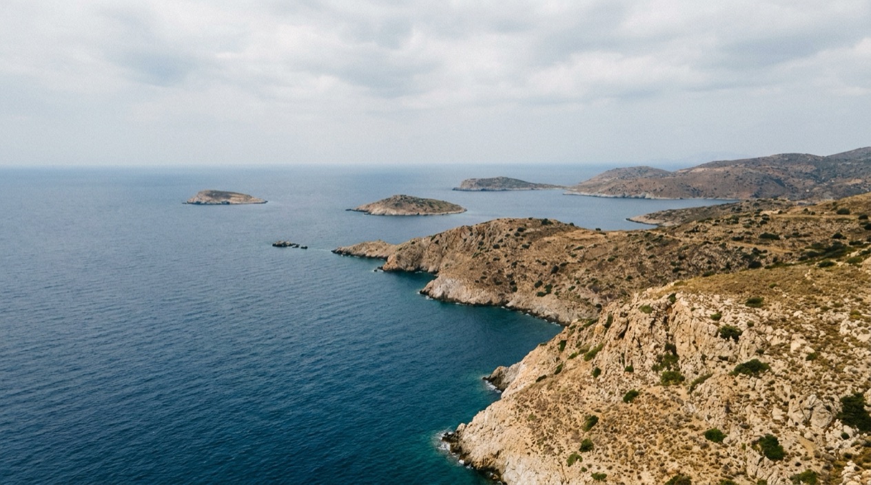
What are the regions of Greece?
Greece is divided into 13 administrative regions plus one autonomous region, Mount Athos. The present system dates from the Kallikratis Plan (Law 3852/2010), which turned the regions into fully separate entities on 1 January 2011. For a traveler, the regions are less a set of borders than a way to sort the country into landscapes: the north with its lakes and mountains, the central mainland, the Peloponnese, and the island regions.
Regions vary a great deal in size. Central Macedonia is the largest and the Ionian Islands region is the smallest, which makes sense when you picture one as a broad stretch of mainland and the other as a string of islands in the sea.
| Region | Area (square miles) |
|---|---|
| Central Macedonia | 7,260 |
| Ionian Islands | 891 |
The mainland regions
Attica surrounds Athens and holds the Acropolis and the beaches of the Athenian coast. Central Macedonia is the region of Thessaloniki, with the Chalkidiki peninsulas hanging into the Aegean. Western Macedonia, East Macedonia and Thrace, Epirus and Thessaly fill out the north, a land of lakes, forests, river valleys and stone villages.
Epirus is where the Vikos Gorge cuts into the Pindus mountains, and Thessaly is where the rock pillars and monasteries of Meteora stand above the plain. Central Greece includes Delphi, and Western Greece takes in the city of Patras and the coast facing the Ionian Sea. Together these regions reward a road trip, with mountain villages, stone bridges, and tavernas serving grilled meat, pies baked with wild greens and local cheese.
The Peloponnese is its own region, joined to the rest of the mainland and holding Nafplio, Mycenae, Epidaurus and Olympia.
The island regions
Four regions are made largely of islands. The Ionian Islands (Corfu, Paxos, Lefkada, Kefalonia, Ithaca and Zakynthos) lie on the western side of the country. The North Aegean takes in islands such as Lesbos, Chios and Samos. The South Aegean groups the Cyclades, with Santorini, Mykonos, Naxos and Paros, together with the Dodecanese, which includes Rhodes and Kos. Crete is a region by itself.
Each region has its own character. The Ionian islands are green and lean toward cypress, olive and Venetian-style town squares. Island groups are useful geographical landmarks, but they do not mirror the administrative regions exactly.
Mount Athos
Mount Athos is an autonomous monastic community under Greek sovereignty. It sits on the easternmost of the three large peninsulas that reach into the Aegean from the Chalkidiki peninsula, so on a map it looks like a long finger of land at the far end of Chalkidiki.
On a Greece map it stands apart from the 13 regions, and it is a place of monasteries, forest and sea rather than a destination of beaches and nightlife. Travelers heading to Chalkidiki will see it named on signs, but it is a separate community with its own rules, and nobody should treat it as one more stop on a beach itinerary.
Where are the main islands?
The main islands fall into a few groups: the Ionian Islands off the western coast, the Cyclades and Dodecanese in the southern Aegean, the North Aegean islands, the Saronic islands near Athens, and Crete on its own at the southern edge of the country. Islands, bays, capes and peninsulas shape Greece, so even a mainland trip often ends at a harbor.
The coastline is among the most intricate in Europe, running to 8,498 miles, a figure that surprises people given that the whole country covers 50,949 square miles. Bays, capes and peninsulas explain it, and they explain why even a mainland trip often ends at a harbor.
Crete
Crete is the largest island of Greece, and it feels more like a small country than an island. Mountain ranges run through its middle, gorges drop toward the Libyan Sea, and towns such as Heraklion, Chania and Rethymno sit along the coast. The Minoan palace of Knossos stands near Heraklion.
At the table, Crete has its own cooking: dakos, a barley rusk topped with tomato and soft cheese, wild greens baked into pies, snails, lamb, and raki poured at the end of a meal. Because Crete is so large, choosing one area as a base is more realistic than trying to cover the whole island at once.
The Cyclades
The Cyclades are the island group people picture first. Santorini is known for its caldera, Mykonos for its windmills and nightlife, Naxos and Paros for long beaches and villages of marble-paved lanes. Smaller islands such as Milos, Folegandros and Sifnos have their own followings among travelers who want a slower pace.
Food varies from island to island. Naxos is associated with potatoes and cheeses, Santorini with fava, tiny tomatoes and white wine grown in volcanic soil, Paros with seafood tavernas by the harbor. In July and August the heat can be intense, with temperatures that can climb above anything you would expect in a European summer, so beach time and shade matter.
The Ionian Islands
On the western side of the country, the Ionian Islands form the smallest region by area. Corfu has an old town of arcades and a promenade built around a cricket pitch, Kefalonia has caves and a long wine tradition, and Zakynthos has the cliff-backed cove that appears on so many postcards. Lefkada is joined to the mainland by a causeway, while Paxos and Ithaca keep a smaller scale.
The cooking leans toward Italy more than elsewhere in Greece. Corfu has pastitsada, a spiced meat and pasta dish, and sofrito, veal in garlic and white wine sauce. Kefalonia is known for its meat pie. Cypress and olive groves cover the hills, and the sea has the blue-green tone that travelers associate with the area.
The Dodecanese, the North Aegean and the Saronic islands
Rhodes and Kos belong to the Dodecanese. Rhodes has a medieval old town built by the Knights of St. John, with walls and stone streets, and Kos has beaches and ruins. In the North Aegean, Lesbos is linked with olive oil and ouzo, Chios with mastic, a resin from trees that grow in its south, and Samos with sweet wine.
Closer to Athens, the Saronic islands include Aegina and Hydra. Evia is separate again, a large island close to the mainland on the Central Greece side, and the Sporades, with Skiathos among them, have forested slopes and pine-backed beaches.
Where are the major cities?
The major cities sit on or near the water. Athens is in Attica and Thessaloniki in Central Macedonia, with Patras facing the Ionian Sea and Heraklion on Crete, while Ioannina and Larissa serve the mainland interior. Arriving in one of them is usually your first contact with Greece, and each has a distinct feel.
Athens and Attica
Athens is the city of the Acropolis, but a day there also takes in the flea market of Monastiraki, the neighborhoods of Plaka and Psyrri, the National Archaeological Museum, and the cafés where people linger over frappé. At night the tavernas fill with grilled octopus, souvlaki, moussaka and plates of meze, while rooftop bars look back at the lit Parthenon.
The port of Piraeus lies within the same urban area, and it is the departure point for many ferries to the islands. Attica also stretches along a coast of beaches and old fishing harbors, and its islands such as Aegina and Hydra belong to the same region. That makes Athens the place where the map of mainland and islands first meets.
Thessaloniki
Thessaloniki sits on a bay and is the hub of Central Macedonia, the biggest region in the country. It is a city of waterfront promenades, Byzantine churches, an old Roman-era heritage, and a food scene that locals take seriously. Bougatsa, a custard or cheese pastry, is a breakfast habit, and the markets around Modiano and Kapani are crowded with spices, olives, fish and pastries.
From Thessaloniki the map opens toward Chalkidiki, with its three peninsulas and beach towns, and toward Mount Athos at the end of the easternmost one. The city also works as a gateway for the north, where mountains, lakes and small villages take over.
Heraklion, Chania and the island cities
On Crete, Heraklion is the city closest to Knossos and has an archaeological museum devoted to Minoan finds, while Chania is a harbor town with Venetian lanes, a lighthouse and a covered market. Rethymno sits between them with a fortress and an old town. Each makes a different base for the island.
Other island towns work the same way. Rhodes Town is built around its medieval walls, Corfu Town around its arcades and squares, and Hermoupoli on Syros around neoclassical mansions. In the Cyclades, the main town of an island is often called the chora, the hilltop village that is the heart of daily life, with the harbor below it.
Patras, Nafplio, Ioannina and Volos
Patras, in Western Greece, is a port city that looks toward the Ionian Sea and the islands beyond. Nafplio in the Peloponnese is a harbor town with a fortress above it and squares lined with cafés, near Mycenae and Epidaurus. Both are often used as bases for exploring the Peloponnese.
Ioannina is the city of Epirus, set beside a lake, with a walled citadel and a tradition of silverwork. It is the gateway to the stone villages and the Vikos Gorge in the north. Volos, on the Thessaly coast, is known for tsipouro, the grape spirit served with plates of small dishes in its meze-style restaurants.
Good to know before you go
Reading a map of Greece is partly a question of altitude and heat. The lowest point in the country is Epitalio, at 20 feet below sea level, while the mountains of the mainland rise high enough to hold villages that feel far from the coast. Rivers are modest, and the longest, the Haliacmon, runs 185 miles.
In July and August the heat is serious, and it can climb well past what the season usually brings, which is worth remembering when you plan a day among ruins or on an island with little shade. Greek place names appear in several spellings on signs and maps, so a stop that looks unfamiliar may simply be spelled another way.
Sources
- Wikipedia, Administrative regions of Greece (https://en.wikipedia.org/wiki/Administrative_regions_of_Greece), checked October 12, 2026
- Wikipedia, Geography of Greece (https://en.wikipedia.org/wiki/Geography_of_Greece), checked October 12, 2026
To plan your stay
- Best Time to Visit Greece: September and Late May to Early June
- Arachova: Parnassus Mountain Town, Formaela Cheese, Ski Season and Saint George's Day
- American Airlines Flights to Greece: U.S. Cities, Athens Arrivals and Onward Island Flights
- Greece on a Budget: Cash Machines, Cards, Beaches and Ferries