
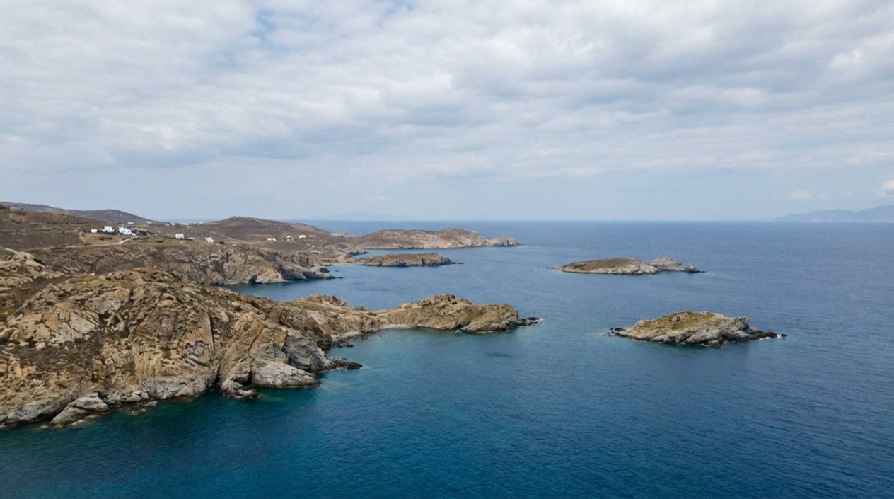
At a kafenio table in a village square, over a small cup of thick Greek coffee, the questions come naturally: how many islands are there, which mountain is that, and why is everyone sitting in the shade? Greece is a country of sea, rock and mountain, with a capital on the mainland and islands scattered in every direction.
What are the basic facts about Greece?
Greece is a Mediterranean country whose capital and largest city is Athens, whose language is Greek, and whose map is made as much of water as of land. It sits at the crossroads of Europe, Asia and Africa, and that position shows in its food, its buildings and the many cultures that have left a mark there.
Capital, language and clock
Athens is where most journeys begin or pass through, a big city that holds the Acropolis and the Parthenon above its neighborhoods of cafés, markets and apartment blocks. Greek is the official language, written in its own alphabet, so street signs often come with a Latin-letter version beside them. Expect to see the same place spelled several ways.
The country keeps Eastern European Time, which is UTC+02:00, and moves to Eastern European Summer Time, UTC+03:00, when daylight saving time begins. For a traveler flying in from the United States, that means a long jump forward on the clock. The first evening tends to run on coffee and a late dinner at a taverna, the Greek family restaurant.
The land in figures
Greece is long on coastline for its size, because the mainland is ragged and the islands add shore at every turn. Mountains rise close to the sea, which is why you can look from a beach to a peak in a single glance. The table gathers the measures that people most often ask about.
| Feature | Figure |
|---|---|
| Total area | 50,949 square miles |
| Coastline | 8,498 miles (11th longest in the world) |
| Highest mountain | Mount Olympus, Mytikas peak, 9,573 feet |
| Longest river | Haliacmon, 185 miles |
| Lowest point | Epitalio, −20 feet |
| Inhabited islands | Up to 227 |
| UNESCO World Heritage Sites | 21 |
Islands and the largest of them
The islands make up roughly a sixth of the country’s territory, and Greece counts a great many of them as inhabited. Some have a single village and a handful of tavernas, others have airports, towns and their own regional character. The island groups each have a distinct feel, from the Cyclades to the Dodecanese to the Ionian islands in the west.
Crete is the largest and most populous island, and it lies out in the sea south of the mainland. It stretches long from east to west and narrows sharply near Ierapetra. That shape gives Crete a coast on both the north and south sides, and a spine of mountains between them. Crete is large enough to treat as a destination on its own.
What is Greece known for?
Greece is known for its islands and sea, its ancient sites, its distinct architecture from one region to the next, and a table of simple food built around olive oil, cheese, grilled meat and fish. A trip can lean on any of these, and the best ones usually mix them.
Ancient sites and the places around them
The Acropolis and the Parthenon in Athens are the names people carry in their heads before they arrive, and the country holds many more places of the ancient world, among them Delphi, Olympia, Knossos on Crete, Mycenae and Epidaurus. The count of UNESCO World Heritage Sites shows how much of the country carries that status, and it includes more than ruins.
Meteora belongs on that list of places people dream about, with its monasteries on rock pillars. Seeing them from the valley below, you get a sense of how different Greece looks once you leave the sea behind. The mountains inland are a reminder that this is not only a country of beaches.
Architecture that changes from place to place
The whitewashed houses and blue-domed churches that fill postcards belong to the Cyclades, and Paros is one island where you find those Cycladic homes. They do not describe the whole country, and that is the surprise for many travelers. In Corfu, the houses and churches are painted in pastel colors and built in a baroque style.
Neoclassical buildings line the streets of Ermoupolis and Nafplio, towns that feel nothing like a Cycladic village. Further into the mainland, Grevena and Kozani hold buildings with an Ottoman influence. Moving between these places is a way of reading the layers of history in stone and plaster.
Food, drink and the table
A meal in Greece tends to arrive as a spread of meze, small plates that sit in the middle of the table: feta, olives, fried zucchini, grilled octopus, dips of eggplant and fish roe. Then come the mains, perhaps moussaka layered with eggplant and béchamel, or souvlaki on a skewer, or a gyro wrapped in warm pita.
Ouzo, the anise-flavored spirit, turns cloudy when water is added and arrives with those small plates. On Crete, the clear spirit is called raki. The kafenio, the traditional coffeehouse, is where locals linger over coffee, backgammon and conversation, and it is a good place for a traveler to sit and simply watch village life.
Mountains and gorges
Mount Olympus is the highest peak in the country, and the Vikos Gorge plunges vertically to a great depth in the north of the mainland. Both are reminders that hiking is part of Greece alongside swimming. The country’s rivers, such as the Haliacmon, and its lakes, such as Lake Trichonida, add to a landscape of water and stone inland.
What should visitors know first?
The first thing to know is that Greece has a strong seasonal rhythm: the sea, the heat, the crowds and the ferries all change with the calendar, so the month you choose shapes the trip more than anything else.
When the visitors arrive
The peak tourist season runs from May through September, and about 75% of all tourists arrive in those months. The vast majority of visitors come between April and October. Tourism is concentrated in Crete, the Dodecanese, the Cyclades and the Western Greek Islands, and to a lesser extent in the Peloponnese and the Halkidiki peninsula in Macedonia.
For visitors from more northerly climates, the off season from November through February can be rewarding. Temperatures are mild, tourists are few and prices are reduced. It is a season for cities, museums, mountain villages and long lunches indoors, rather than for the beach.
Heat and the meltemi
The warmest time of the year starts in mid-July and generally lasts until mid-August. Daytime temperatures in July and August climb high, and they can go well beyond the usual range. The annual meltemi winds from the north cool the country during that same stretch.
From mid-July to mid-August, most Greeks avoid heavy physical activity outdoors between 13:00 and 17:00 because of the strong midday sun. Visitors tend to follow that rhythm, with sun protection, water and a long break in the shade.
Ferries and the calendar
Ferries tie the islands together, and the weather and the holidays shape how they run. From January to March, Aegean weather can be extremely rough, and ferries are often kept in port for days at a time. A winter trip to the islands needs room in the schedule for those delays.
In August, ferries fill up because of the National Holiday on 15 August, so travelers should plan ahead. The date falls in the middle of the high season and adds a wave of Greek families on the move to the usual crowd of visitors.
Arriving by your own boat
Sailors face their own set of rules. Boats arriving in Greek waters must pay the TEPAI boating tax on the day of arrival, the fine for not paying is high, and the tax must be paid for each calendar month a boat stays in Greece. Boats must also carry liability insurance that explicitly states coverage is in accordance with Greek laws.
Boats with an EU flag arriving directly from a Schengen country do not need to check in, but must have an updated crew list on board. Boats with a flag from outside the EU must check in at a port of entry, visit customs, buy a transit log, and have it stamped by the port police at every harbor visited.
Good to know before you go
Greece rewards a loose plan. In summer the sun is strong, so a hat, sunscreen and a water bottle are plain consequences of the season, and the northern winds of the meltemi make the Aegean breezy at the height of the heat. A day by the sea can pass in a swim, a taverna lunch and a slow afternoon in the shade.
In winter the picture flips: cities and mainland towns are pleasant for walking, island ferries can stay in port, and the Aegean turns rough. Each season gives Greece a different face, from the beach in July to the quiet kafenio in January.
Sources
- Wikipedia, Geography of Greece (https://en.wikipedia.org/wiki/Geography_of_Greece), checked October 12, 2026
- Wikipedia, Greece (https://en.wikipedia.org/wiki/Greece), checked October 12, 2026
- Wikivoyage, Greece (https://en.wikivoyage.org/wiki/Greece), checked October 12, 2026
To plan your stay
- Best Time to Visit Greece: September and Late May to Early June
- Arachova: Parnassus Mountain Town, Formaela Cheese, Ski Season and Saint George's Day
- American Airlines Flights to Greece: U.S. Cities, Athens Arrivals and Onward Island Flights
- Greece on a Budget: Cash Machines, Cards, Beaches and Ferries